October 2019
The sky hangs low, cutting off the hilltops, and rain splatters the windscreen. In this light the grass is vividly green, snakes of pale wall dividing fields into random shapes and sizes. It is a sight unique to this country and typical of this county: Yorkshire. God’s own county. (Kiwis please note the lack of the letter ‘r’ before you castigate me.)

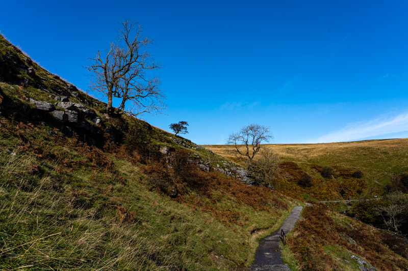
This is proper Yorkshire, hills and dales, no flat land. It’s terrain that makes your legs work. No such thing as a gentle stroll around here, you’re either climbing or descending. In the middle of the three peaks – famed for the challenge of climbing (or running) all three in the same day – the Ribbleshead viaduct splits the countryside. One side stretches to spectacular wildness, nothing but rough grass covered hills, heather clad moors, and sheep. A track leads into the distance and for miles thereafter: the Pennine Way. My heart would love to walk it but my body declines.
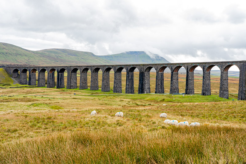
The Ribbleshead viaduct is a serious feat of engineering, towering arches across some of the most inhospitable countryside in England, the sort of terrain where the SAS might undertake endurance training. It’s also a spectacular sight, almost black against the autumn colours, a few buildings in the same dark stone on one valley side – a pub, the station, a couple of houses. It’s possible to see all three peaks from here: Ingleborough to one side of the wide valley, Whernside the other, and Pen-Y-Ghent in the distance.
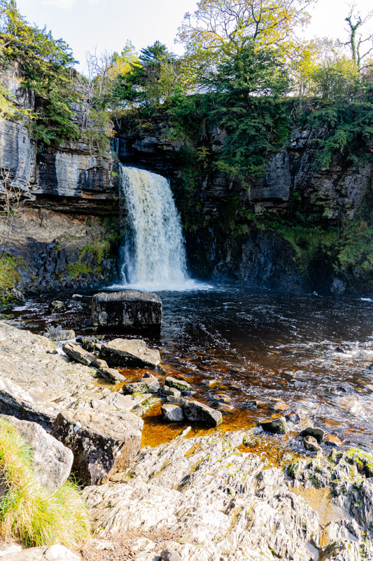
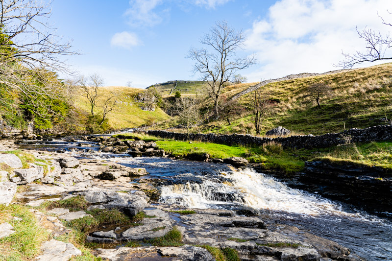
Away from the wildness, back past the viaduct, the road drops towards civilisation and Ingleton, through fields and trees, lines of limestone cliffs edging the sides. A 4½ mile circular walk leads up one river valley gorge and down another, passing multiple waterfalls on its way, including one famously painted by Turner. We’re surprised to find there’s a £7 entrance fee but we’ve paid as much to see sights overseas (mainly in Slovenia) so hand it over, somewhat reluctantly.
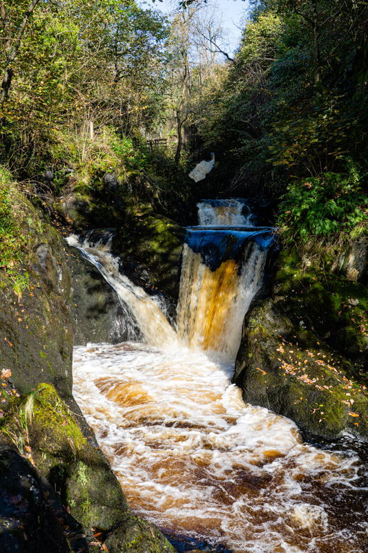
The path is wet and muddy, stones slippery with a coating of soggy leaves and soggier earth. The sound of rushing water is constant as we walk close to the river, climbing up beside it in steps. The first falls are announced by a deep booming that bounces off the narrow canyon walls. The water is amber-yellow as it hurls itself over the precipice, dark and deep in the pool beneath, the colour of strong Yorkshire tea in the shallows – stains attesting to its source high on the peat moors.
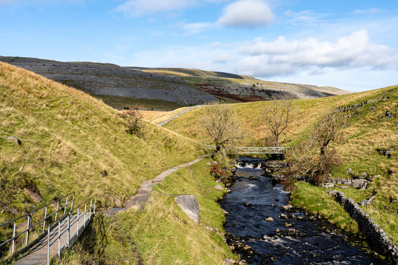
We break out above the gorge and cross farmland, the view opening up towards Ingleborough in the distance, looking smaller than it is, easier to conquer than the tough reality. From here the gorges are almost hidden, a few treetops barely visible to show they exist. We drop into the second one, the water falling beside us, a steep cliff opposite. A gaggle of school children march past, a few haring off down the treacherous path, the teacher asking them not to break a leg as ‘the paperwork would be horrendous.’
As we walk back to the car, glad we paid the fee, spits of rain fall, and on the road shallow lakes spread away from both sides. They should be fields. There has been so much rain here in the last few weeks the ground can take no more and has abandoned all attempts to suck it in, leaving it lying carelessly where crops should grow and animals should graze. I’d hate to be a farmer.

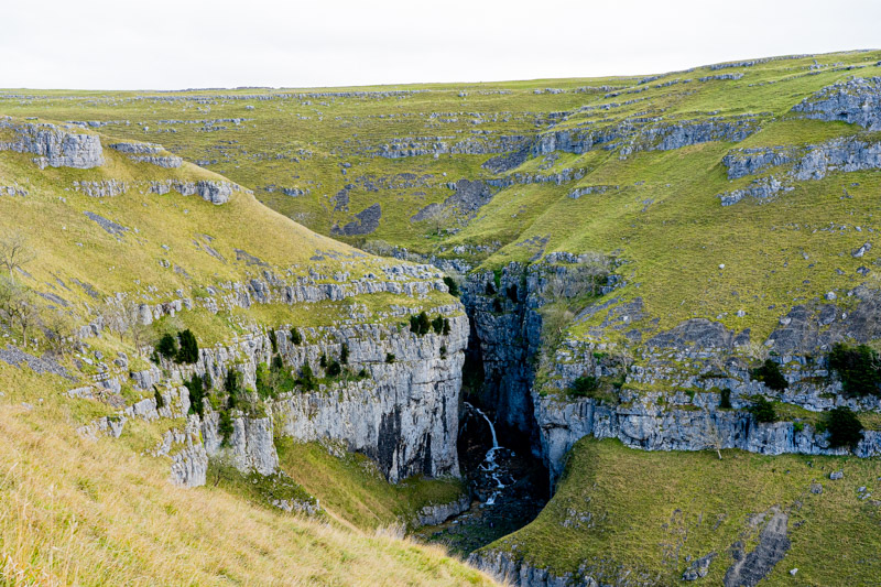
There’s a lot of limestone around here and it makes for some amazing sights, including those around Malham. We walk via Janet’s Foss, named for Jennet, the Queen of the Faeries, Foss being a Scandanavian word for waterfall. I can see why fairies might live here, twin spouts of water falling into a sheltered pool, but we’re a bit waterfalled out and it doesn’t compare to any of those around Ingleton. The path leads us into Gordale Scar where the valley narrows, within 100m, to a steep-sided cleft in the rock, spectacular and skyscraper tall – and a little bit scary. It looms over me as I look up and, despite that it’s been here a while, created in the last ice age, looks threatening. I picture myself buried under tons of rock and scurry out whilst Neil lingers with his camera.
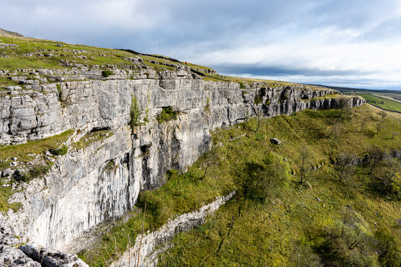
We begin to climb as the rain begins to fall, the latest in a series of short showers that has accompanied our recent walks. Cresting the ridge over Malham Cove the wind hits us with a sudden force that could knock the unwary over. We bend into it, soon drying out, heading for Malham Tarn. The water shines deep blue, edged with the golden-orange and browns of autumn trees. As we turn past it clouds darken the surface and the wind whips small waves into the far shore. We descend on part of the Pennine Way into a small valley, the going tiring and precarious over uneven ground lined with rocks rimed with mud as slippery as solid ice.
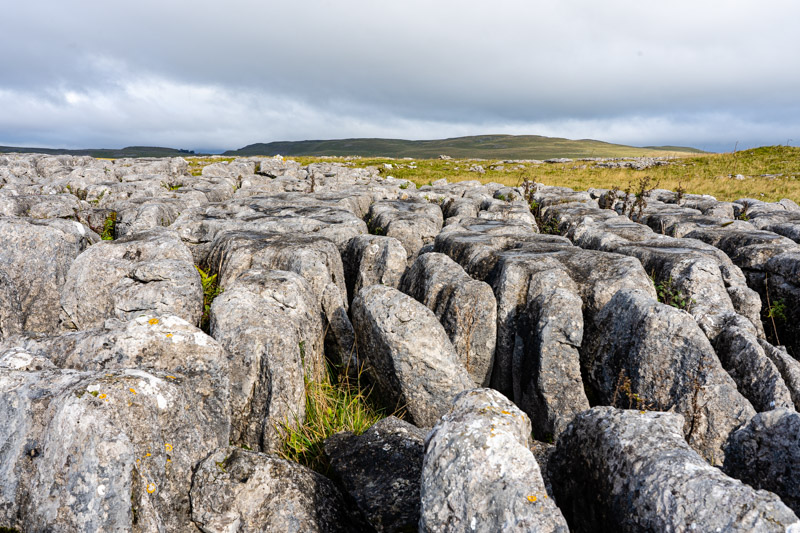
The limestone pavement at the top of the Cove looks flat from a distance but it isn’t. Over millennia water has eaten away at the stone and clints – large slabs of rock – are isolated by grikes – deep fissures – that run between them. It’s hazardous territory, not easy to walk on, surfaces riven with deep holes. We clamber across it and down the steps cut into the rock at the far side, all 400+ of them. I don’t count; I trust the guidebook.
I’ve written much about the beauty we’ve seen on this trip and the wonderful places we’ve visited. I’m now reminded that I used to live in one of the most stunning places on earth, packed solid with more beauty than it’s possible to believe. We could spend months just travelling around our old home country without tiring of it. There’s a reason it’s called Great.
