As I go about my daily life I have a constant nag telling me I haven’t yet finished our Newfoundland stories. Particularly apposite is that it’s about a year since we put the final touches to our itinerary and started booking flights and accommodation – the memory of our credit card bills from this time is one I’d rather filter from my brain but, like all bad ones, it hangs around. At least the good memories that came from the bills do too.
5-9th August 2023
We leave Gros Morne National Park and begin our return journey to St John’s on the Trans-Canada Highway – the only road that traverses the island – pausing for a couple of short strolls, both through forest, the sun filtered by green, both ending up at water. The first is by a memorial celebrating the life of a Mikmaq tracker whose value to settlers was such that he was named a ‘person of national significance’ with, it seems, not a trace of irony. The damp around us and underfoot, debris and fallen trees, suggests that the small stream the trail leads to, which gurgles around rocks and roots, has at some point more than gurgled. The second walk leads to a waterfall, signs along the way inviting us to try forest bathing, which seems to involve pausing and enjoying being amongst the trees, letting their calm wash over you as you would the water in a bath. Sounds good to me.
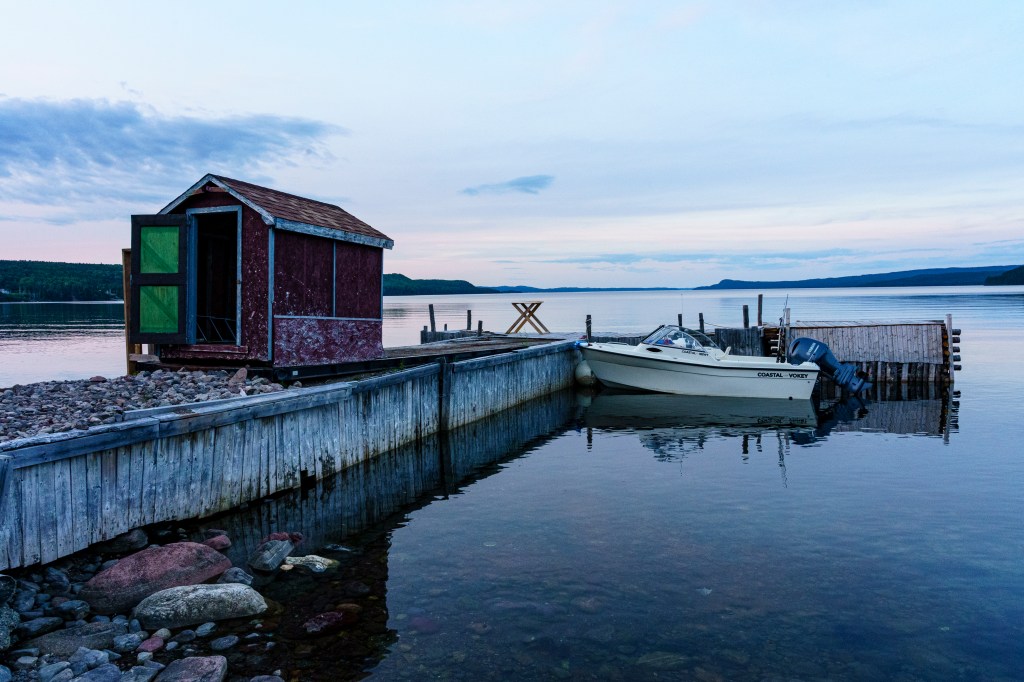
Calm is today’s word. The small cabin we will call home for a couple of nights, beautiful and cosy with generous hosts, is at the very edge of water that is so still it could be a frozen lake rather than the sea. There is no visible opening in the lines of land that stretch away from us on either side, a distant smudge of town on the left, muted lights appearing as a damp dusk falls. The lights of the dozen or so houses in this settlement hardly pierce the dark when it arrives.
The next morning cloud sits low on the water, the sun a lamp-like glow from above reflected in it. Our plan is to walk the King’s Point Trail, not a long walk but the destination is a hilltop accessed by many wooden steps, and noted as strenuous whenever we’ve seen mention of it anywhere. It begins at a small hut that serves as information and toilets, a smiling and friendly young woman chatting enthusiastically about the walk, asking us to sign the visitors’ book as we enter and return.
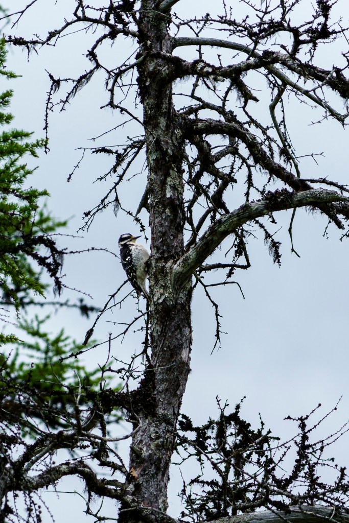
The trail undulates through sparse woodland, breaking into an open area with a few tangled trees poking from low scrubland. Movement draws my eye and I wave at Neil to slow to avoid disturbing the bird that clings to a small tree nearby. We watch as it flits around. What is it? I wonder aloud. Woodpecker, Neil says. It’s not pecking! I reply, the same instant that it drills into the tree with a knocking sound. I’m amazed at being so close, even more so that Neil is right – his bird-recognition skills aren’t great. A further surprise is it hanging around long enough for him to get a photo.
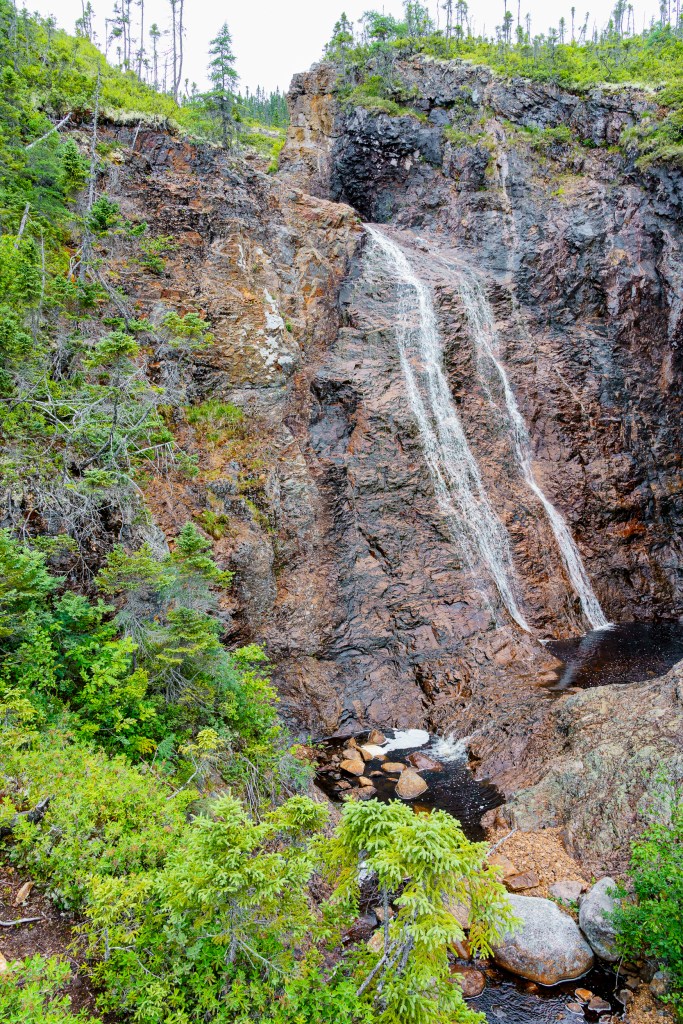
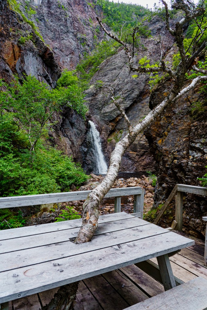
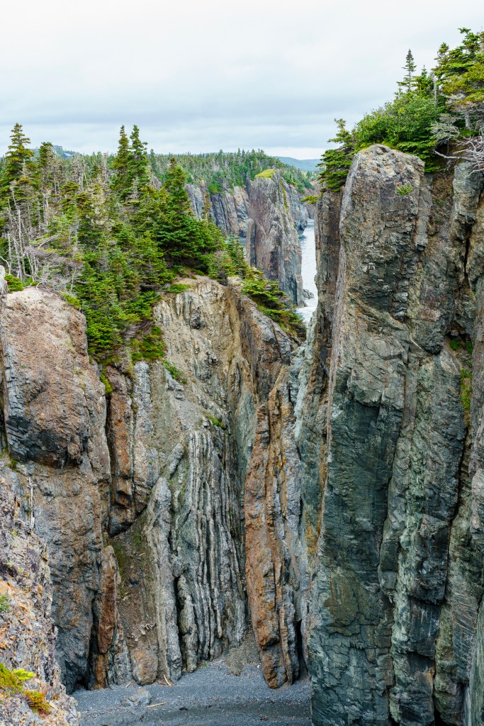
Someone has clearly spent a lot of time and effort to create this walk, much of it boardwalk and stairs, seats and picnic tables on platforms dotted along them. We climb steadily beside a steep-sided gorge, then down again (two hundred steps, a sign warns – of course I count them: 203 actually) to a waterfall. The effort is worth it, the water cascading from a high cliff and dropping straight into a small pool, stark white against grey rock shot through with orange and cream streaks, luscious green surrounding us. The cliffs rise tall and sheer, dwarfing us and the river, which disappears around a tight bend; the air is fragrant and cool. A picnic table has been built around a tree, the trunk of which protrudes at an angle through its top.

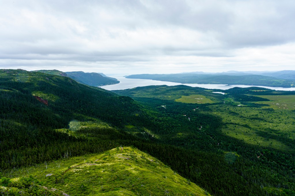
We climb out of the gorge and up more steps, past the tree line and to a small bench sheltered from the wind by the hill’s peak, where we pause to eat lunch as spits of rain suggest we’d better not hang around long. At the summit the views are outstanding, 360°, the outline of the long bay clear below, the land rising in layers that soon fade into the cloud. Small ponds reflect the pale sky, shining like fresh snow. The descent passes more water that slides down rockfaces rather than falls, in one place a narrow pale snake twisting through the trees. The walk deserves its reputation as one of the best on the island and the small town is a good support act, neat and clean, benches painted bright colours and flowers in old oil cans suggesting that those who live here care for it and want others to do the same.
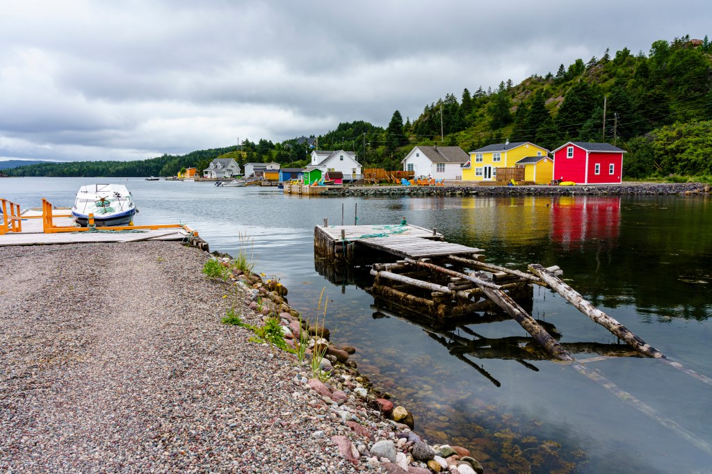
The next morning the rain arrives and shows no sign of leaving so we drive out to the Bumblebee Bight Inn on Pilley’s Island for lunch. Like many of Newfoundland’s islands, Pilley’s is joined to the mainland by a narrow causeway, with colourful buildings dotting the landscape. As I have been many times in this land, I’m reminded of Slartibartfast designing the fjords, and guess he must have been responsible for this coastline too. Rough headlands jut into a mirror-calm sea that twists into small bays and imperceptively rises over pebbled beaches. There are few people around and the whole area has a sense of serenity hanging over it, an atmosphere helped by the low cloud and still sea.
Cloud layers the water as we pack the car up the following day, a gift of cod from the cabin’s owner in the chilly bin. A quick stop in Gander for groceries sees us shivering from the car, hardly believing that on our visit three weeks ago we felt as though we were walking around in a warm bath. Pauses in our journey now are merely pit-stops on the way east, chosen for location rather than what they offer tourists, but a couple of nights at the base of the Bonavista Peninsula gives us the opportunity to do a walk we’d missed on the way out.
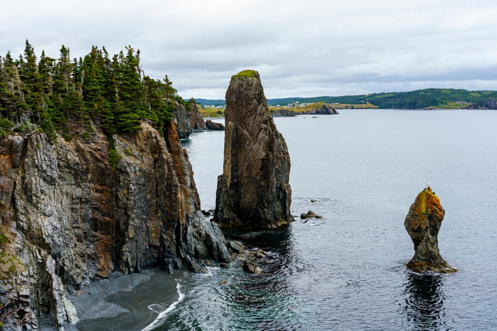


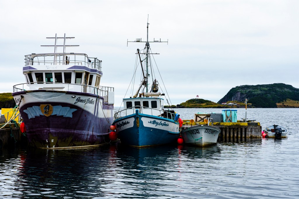
The Skerwink Trail is ‘one of the top 35 in North America and Europe’ according to Travel and Leisure Magazine, albeit twenty years ago. Fearing it would be merely a busy highway of walkers we deliberately chose another in the area when we passed through before but so many have mentioned it we feel, given we have the time, that we ought to give it a chance. As we suspected, it is popular, the small carpark full, cars spilling out onto the roadside for a few hundred metres each way. One of the easier walks we’ve done, it rises and falls around a headland, gaps in the trees offering views across to Fox Island and of magnificent cliffs with tall stacks rising from the sea, one teeming with shags/cormorants. The track swings around to a perfect view of Trinity before dropping back into the trees and towards the car park. Given the amount of people around I’m surprised there is nowhere we can spend money in the local economy, no café or small shop. Fortunately we have sandwiches and we drive to a picturesque bay with fishing boats moored to the wharf in front of us, where we munch contentedly. A few km inland we pause for a quick tasting at a recommended brewbar. Well, we’re not likely to be back, are we, and we don’t want to disappoint.

Great story of your adventures the photos are stunning.
LikeLike
Thank you!
LikeLike