Given that most of Newfoundland is likely to be under a few feet of snow right now it may seem strange to read this, but please note the dates. I’m still catching up on our trip, the hold up with posting often being the wait for photos – my photographer is a busy man and a perfectionist, so I’m not allowed to sling any old pictures on here. The ones he wants to share have to be carefully scrutinised to ensure focus, framing, and whatever else he does when he’s sitting in front of the keyboard squinting at the screen. Anyway, enjoy, especially those of you who are now in the throes of winter.
31st July-4th August
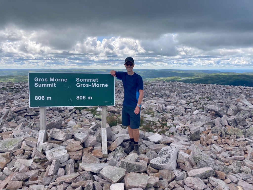
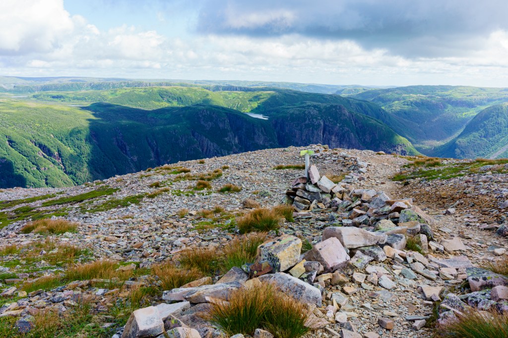
When in Gros Morne National Park the ‘must-do’ hike is to the summit of the mountain after which the park is named. But it isn’t an easy walk and comes with as many warnings as our own Tongariro Crossing does. Since I discovered its existence I’ve been dubious of my ability to complete it, primarily because it is rock, rock and a lot more rock, the path up to and around the summit very rough underfoot. I need softer terrain, especially downhill, or I suffer a lot of discomfort.
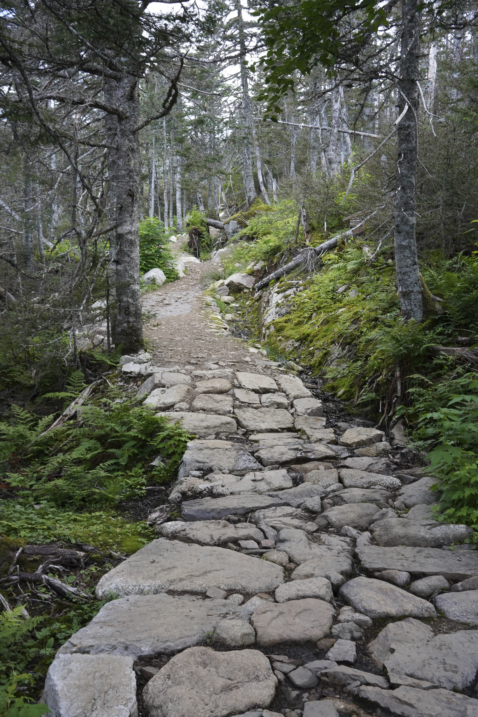
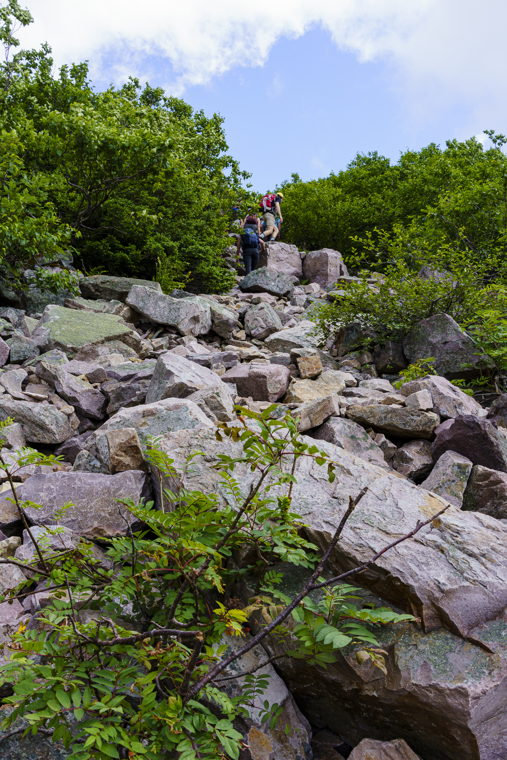
The walk to the base of the mountain is nearly five kilometres long, a constant uphill, and challenging enough. Although the path is wide and well-maintained, the last km or so, when it becomes narrow and muddy, is tricky and in some places impossible to bypass. We see a lot of people trying, balancing on the track edge and slipping and sliding in shiny white trainers. Ahead is the gully that is the hour-long scramble up the mountain, a vague path visible in places but mainly just a tumble of loose rocks with scattered blobs of hikers. I began the walk prepared to turn around when the going gets tough. And it does. I last about a hundred metres of stumbling over small stones and stepping on larger ones that roll alarmingly beneath my feet – the serious climbing not yet begun – before I wave Neil off and retrace my steps.

Walking down alone is strange, a part of me missing. I pause at times, scanning the slope with binoculars, picking him out as he climbs. By the time he is halfway I can barely discern which dot he is. Later, his report is of a very rough path, indistinct at times, especially coming down when a couple of times he had to guess which way to go. Despite this, the circuit of the summit and the descent take him an hour less than the recommended time. Had I been with him it would probably have been an hour longer.

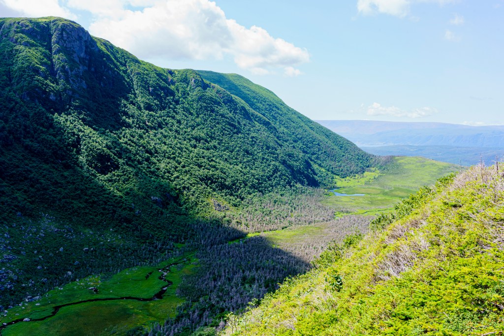
Rocky Harbour sits on a wide sweeping harbour between the sea and the northern peaks of the park which, in case you’re interested, are the northernmost point of the Appalachian range that begins in Alabama, USA. The pretty little town is busy with coaches of tourists arriving to stay in hotels larger than any we’ve seen so far on the island. Our accommodation is a small cabin, quite basic but spotlessly clean, and with lovely owners who live on-site and want to do all they can to ensure you have a good time. A small stream runs beside the cabin – handy for cooling hiking-hot feet – and the hiss of water over a low weir is constant. We leave the bedroom window and curtains open and Neil mumbles in the night when the full moon wakes him, a bright spotlight shining directly in his face.

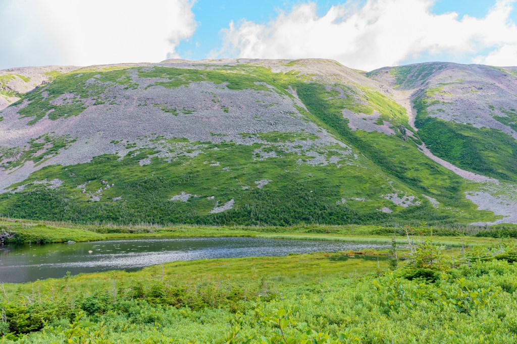
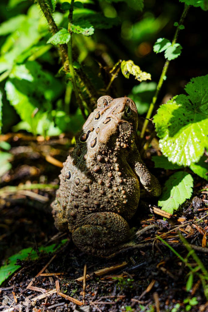
Gros Morne is a park of juxtaposition: for every strenuous full or even multi-day walk there is an hour-long amble. These take you along beaches and river paths, through forests and meadows, to small ponds and waterfalls. We climb a small hill after an impressive thunderstorm (which struck just as we were preparing lunch after an earlier walk) and the path is littered with toads, some shuffling out of the way as we approach, some just sitting there, a dangerous choice given how well their bodies camouflage into the background. How can something be so ugly and so cute at the same time?
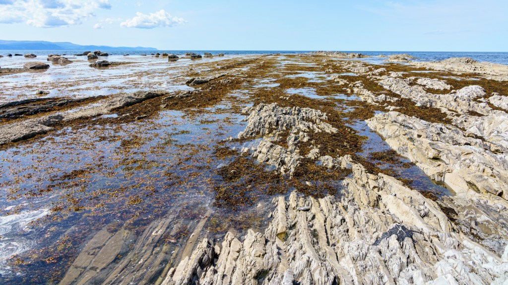
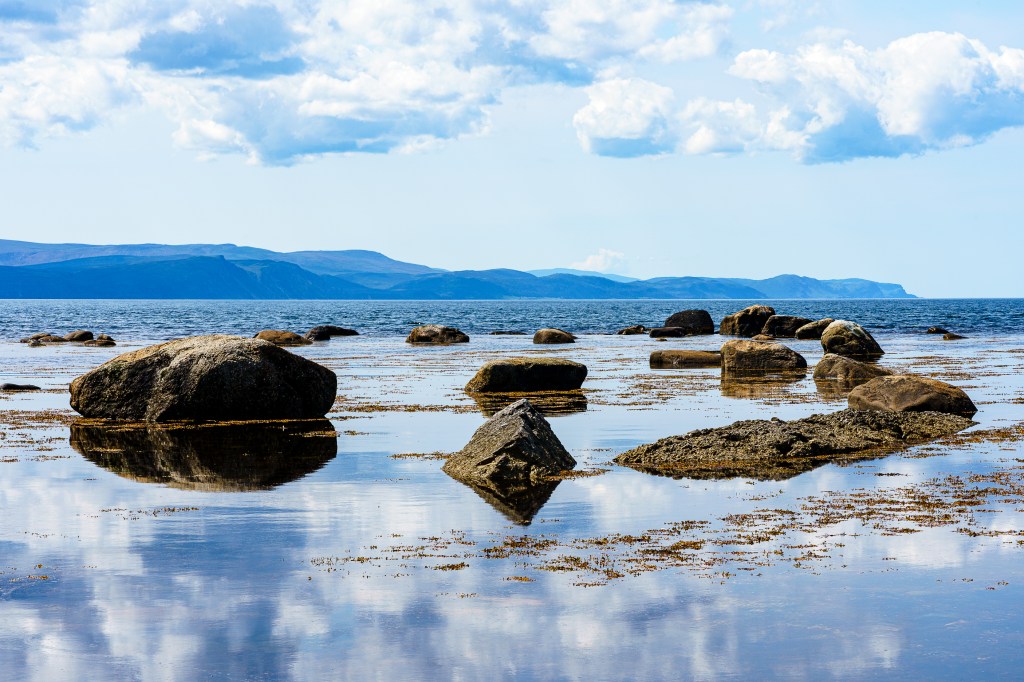
Our final park experience is one we hadn’t planned. Having done so many coastal walks we’d decided to give Green Point a miss, but a couple in the cabin adjacent to ours recommend the guided tour. It turns out that this isn’t really a walk, just a stroll from the car park to the point and a talk about the geology of the area. The guide is, once again, excellent, her knowledge leading me to presume she is a qualified expert but, no: I just read books she says.
There are a few children in the group and she entertains them as much as she informs us, pointing out cliffs where the earth’s plate movements have pushed horizontal layers into vertical, ruler-straight, lines. Layers of soft shale and hard stone tower above us, lozenge shaped tablets of the latter scattered on the ground where they fall when the shale between them crumbles away. Beneath our feet the same layers, worn away by millennia of tides, stretch into the water, topped by large boulders moved by glaciation, smaller ones shifted by the sea. At the point itself a wide band of concrete-looking conglomerate rises, a sign of a massive landslip or shift millions of years ago that buried small crustaceans (when the land was underwater). I still find it hard to think that all this has only been known in my lifetime.

On our last evening, after a lovely dinner at a local restaurant, we catch a fireworks display as we stroll back to the cabin. It’s a fitting end to our time in the park.

Beautiful writing as always Sis, you take me round the world with you, love it.
If it had been me that did the walk with Neil it would’ve been 2 hours longer, if our Anthony had been there he’d still be sat talking to the toads now lol.
Love to you both xx
LikeLike
Oh that made me laugh! Love you xx
LikeLike