25-27th July
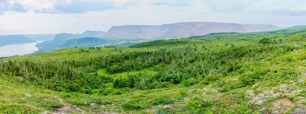
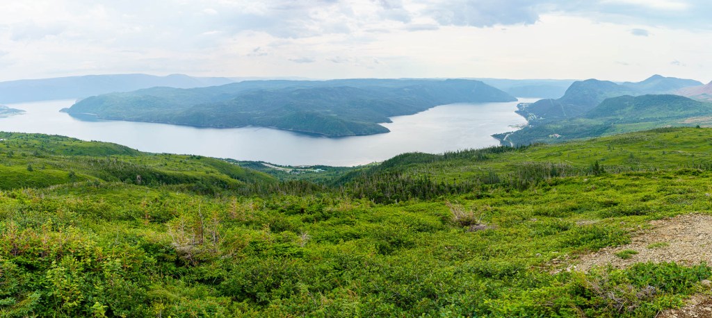
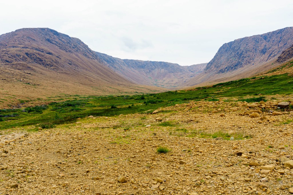
Gros Morne, the largest National Park in Newfoundland, is effectively split into two where the sea punches inland with the long, steep-sided, arm of Bonne Bay. The hills rise behind our accommodation, the sun sinking into them in the early evening and offering a brief respite from the heat. The next morning ominous clouds lurk and the threat of thunderstorms means our planned walk on an open plateau has to be postponed. Instead we hike the Lookout Trail, a path of climbing and switchbacks through sparse forest more varied than most we’ve seen, rounded sycamore and maple interspersed with pointed spruce and fir.
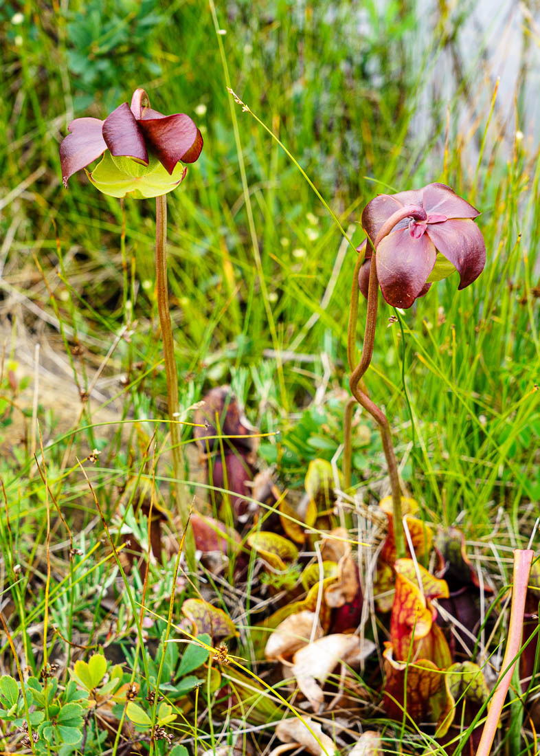
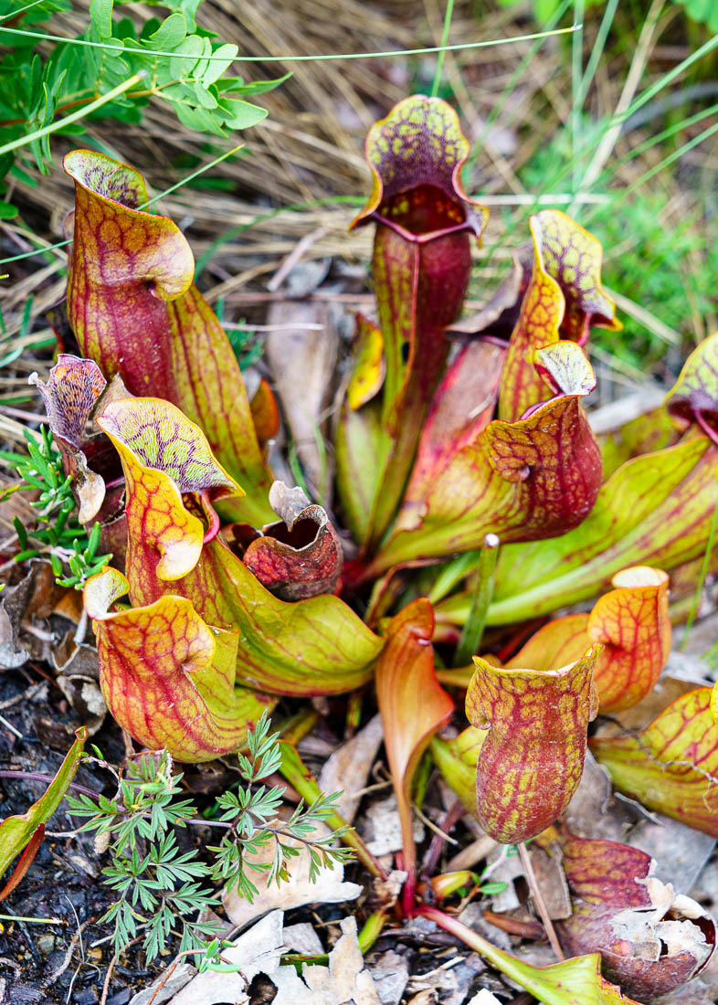
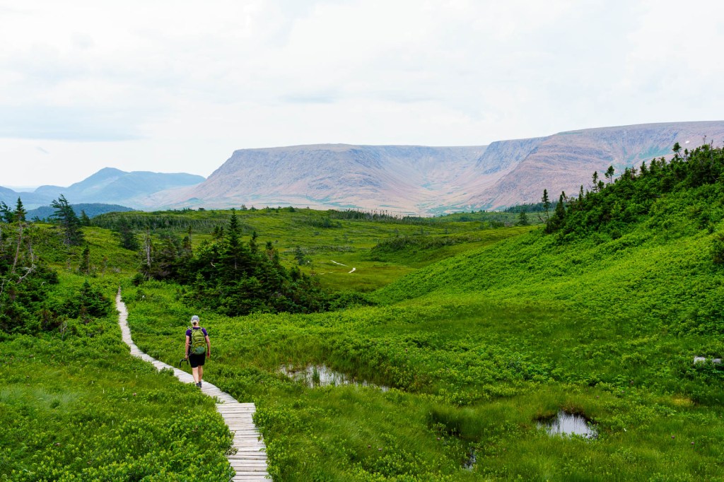
The path is wide, a mix of stone chips and packed earth with ledges of rock at regular intervals to allow for water runoff, and a constant climb until we clear the forest onto a boardwalk crossing open ground, where my legs enjoy the easier walking as a breeze cools my body. Standing water glints through the green around us and flowers poke their heads up, the pitcher plant one of them.
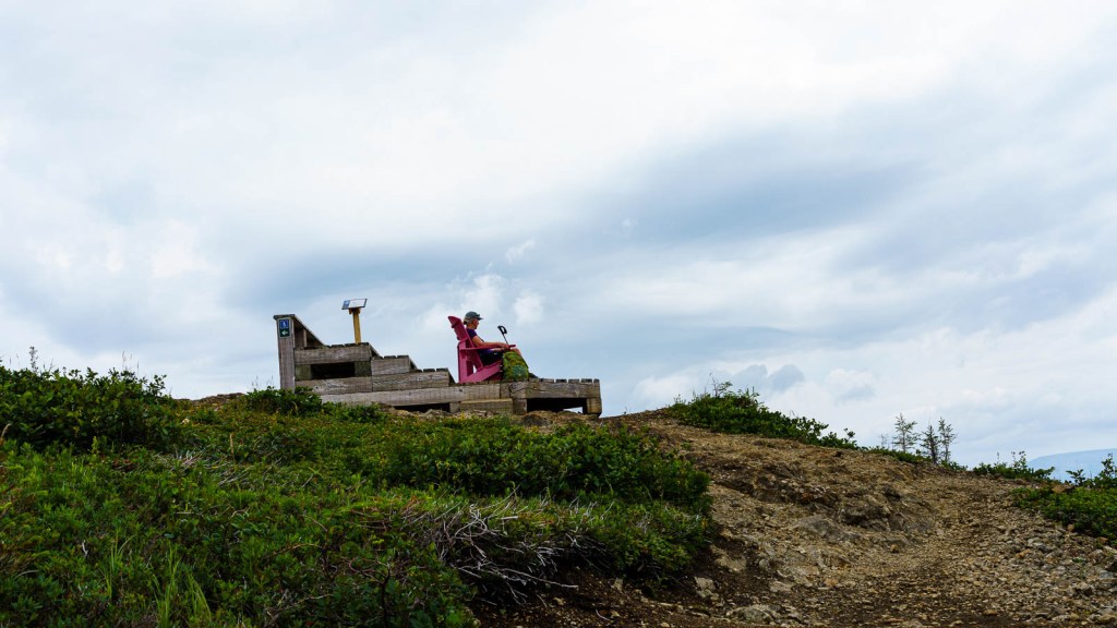
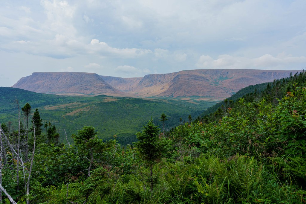
At the top, as advertised, the views are worth the hike, Bonne Bay below us glistening silver-grey under the clouds. To the south are the flat humps of the famed Tablelands, distinctly brown against grey sky and green hills; to the north and across the bay, Gros Morne mountain is dark and round. A couple of red Adirondack chairs sit at the lookout, a Parks Canada initiative that began here, encouraging people to visit wild places.
We wander around the summit loop, my mind wondering if my eyes are lying to it: the path, pushing between low bushes with tangled roots and leaves similar to the bilberry bush, is springy underfoot and, with the dark mass of Tablelands masquerading as the distant moors, I could be rambling the paths of my childhood.
The next day we join a short guided walk onto the plateau that helped Gros Morne acquire its UNESCO World Heritage Site status. This is where the concept of plate tectonics, the movement of sections of the earth’s crust against each other, was proven in the 1960s. (I learned about this in school and am surprised to discover it is only as old as I am.) The Tablelands are part of the earth’s mantle – the layer beneath the crust – visible in only half a dozen places in the world, the others not so easily accessible (for instance, the Galapagos Islands) or underwater. Here, a short walk from the car park, we stand on land that was deep underground until it pushed skywards roughly half a billion years ago.
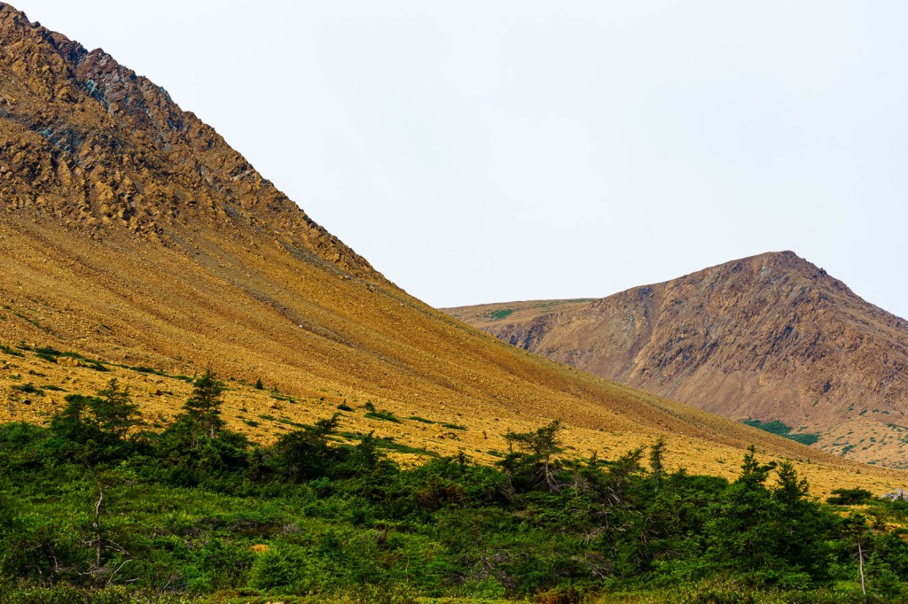
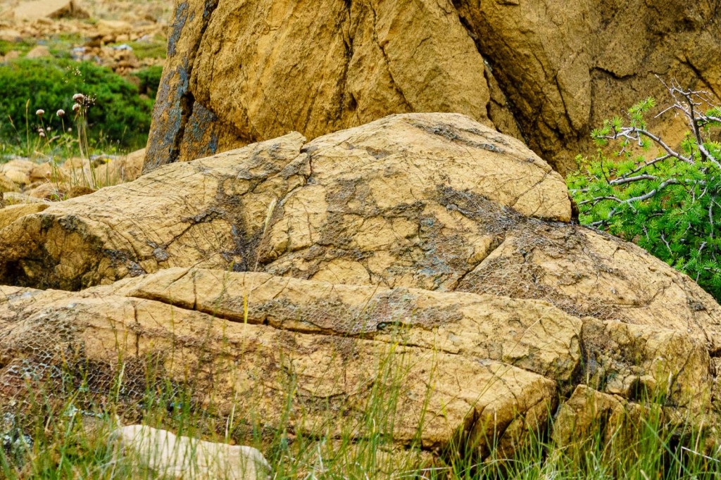
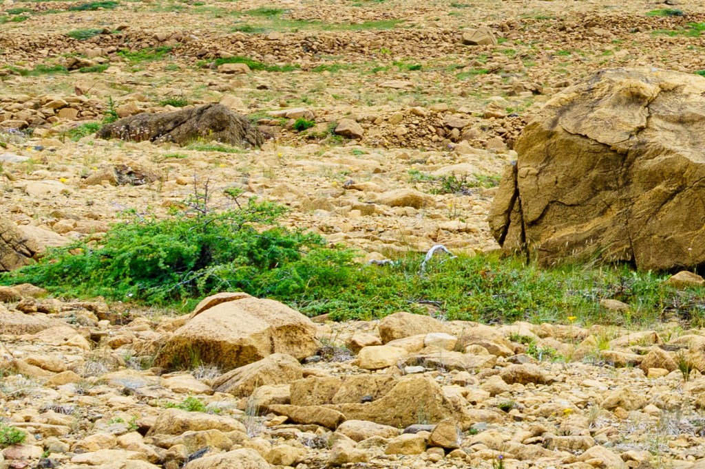
The guide regales us with science and fascinating facts, such as the natural colour of the surrounding rocks is black or dark green, but because they are stuffed full of iron they rust as they are exposed to air, hence their red-brown appearance. When these igneous rocks crack or split, allowing water to enter, they metamorphose into serpentinite rock, so called because the patterns that form resemble snakeskin. I’m entranced. Oh, and the reason little grows here is because the soil is poisonous. Anything that does manage to cling to life has to get nutrients in other ways and remains stunted and small – he points to a tree over a hundred years old, a tiny thing growing along the ground, woody and rooty with a ‘trunk’ about an inch in diameter. Staggering.

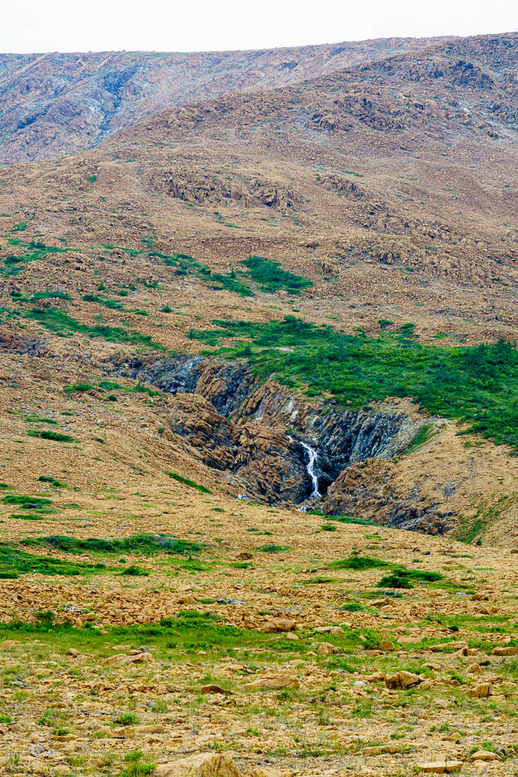
A small stream flows from a dip in the plateau beside the path, the dip being a huge bowl with one side missing where a glacier wore it away. The bowl is the snowiest part of Canada, accumulated snowfall reaching sixty metres on average (the town of Woody Point at sea level gets twenty-two metres). I can’t comprehend what that must look like. The track ends in the middle of a wide flat-bottomed circle, perfect territory for the formation of a glacier which, as it flowed, would wear away the land to form a bowl. We just have to wait a few million years.

Beautiful writing-I was there!!! And beautiful photos
LikeLiked by 1 person