The road north of Ohakune, although not as familiar to us as that south – our route to Wellington – is a beautiful stretch of road. To me it screams New Zealand more than any fiord or alpine view, with Mt Ruapehu looming over a plain of harakeke, last year’s dead stalks standing to attention from it, edged by the graceful toetoe bending and waving in the breeze.
Sometimes we ignore the draw of the mountain – me waving as we pass it – and follow the road farther north, dropping sharply off the volcanic plateau and sweeping past farmland until we reach a cluster of buildings that form the town of Owhango. In England it would be a village; here it’s a small town, one you’d hardly think about as you zip past on SH4, maybe noticing buildings instead of fields. Nestled against the railway line is a small parking area with camouflaged toilets (and whoever came up with the idea of plastering images of native bush across otherwise utilitarian buildings to prevent them being too obtrusive really does deserve an award) where people leave their cars, waiting patiently for trucks to rumble past, to cross to where more cars line the shoulder outside a glass-fronted building. The Blue Hills Café is thriving for good reason: great coffee and good food, with the best vegetarian big breakfast in New Zealand.
When we’ve fuelled our bodies we leave the main road at a sign for the Ohinetonga Scenic Reserve. Signs for such reserves proliferate all over the country and they often annoy me. As rookies we would search for a place to park near such, the aim to break our journey with a picnic. We soon discovered that these signs are not all equal – the loose definition of a scenic reserve is: an attractive patch of native bush, often close to a road, that is protected and therefore cannot be developed, and most are merely a small area of trees in the middle of cultivated land and offer no place to pause.
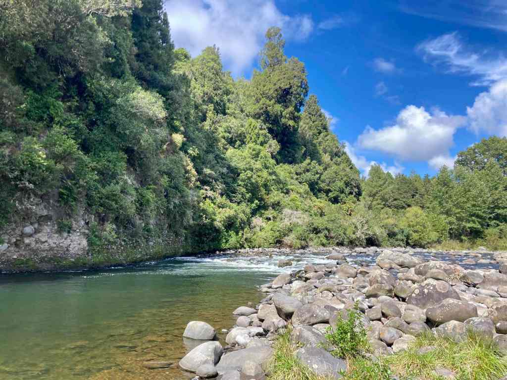
Ohinetonga is different. Larger than many, a couple of kms of gravel road through the forest leads to a small car park by a large grassy area with picnic tables. Down a steep bank the Whakapapa River bubbles over rocks and boulders. A few hundred metres across a concrete road bridge is where the 42 Traverse spits out muddy mountain bikers from their arduous trek across the Central Plateau. Currently closed after slips tore part of it away, it’s described as one of the most challenging tracks in the north island, therefore one I’ll never do. Even Neil would find it hard, primarily the required navigation and, should he ever attempt it, I’ll likely never see him again.
A path leads from the picnic area into the bush, a sign warning that the track ahead is closed. True, there is a small wooden barrier, but if you approach from the other direction there are no signs of closure, and the first you would know of an issue is when you reach the barrier having already traversed the closed part. I don’t advocate rule-breaking but this does seem weird to say the least, and I know we’re not the only people who ignore the sign and scramble across the fifty metres or so of uneven terrain before continuing.
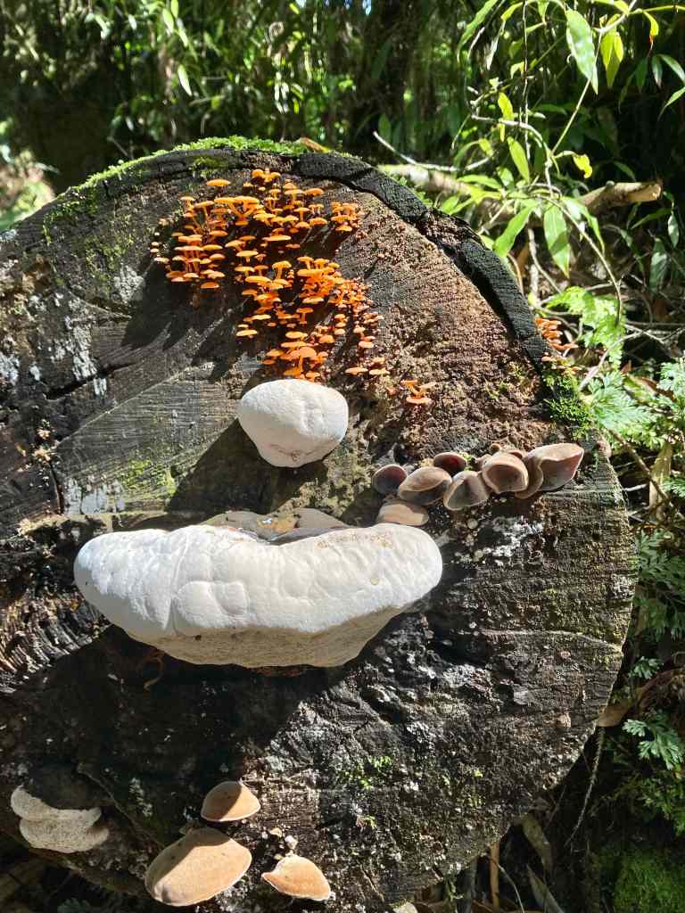
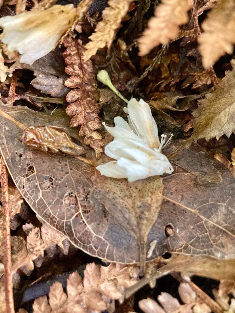
We meander through sparse bush, dropping down to pop out to an open area. A path detours to a grey sandy beach and the river, shallow on this side, deep in the shade of steep cliffs the other. At the end of a walk on a warm day it’s probably inviting but I’m not yet hot enough to brave what looks like ice-cold, although glass-clear water. We return to the track and zigzag up through mature trees shading the sun. Tiny, tulip-shaped, white flowers litter the ground like snow. I pause and look up, but it’s impossible to identify from which tree they come. A party of funghi and mushrooms cluster on the end of a felled tree. We clamber up the rough track, across muddy patches and around tree roots, boards covering the worst parts. A runner pounds towards us and I admire her lack of concern for her ankles on the uneven ground.
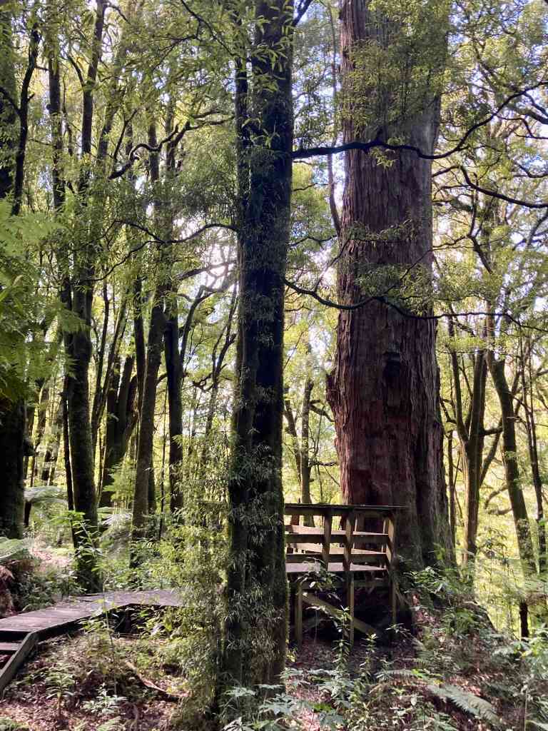
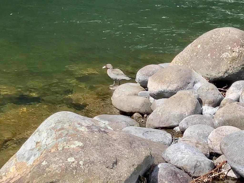
Across the access road the track drops down via steep steps to a secluded and peaceful lagoon, the water moved only by a silent duck gliding into the tall reeds as we approach the boardwalk crossing. Another line of boards, elevated, skirts a huge tree, a hundred-plus-year-old totara, its crown hidden from view by the surrounding trees, before the path returns to the river. At the water’s edge the heat thrown back at us from the grey rock makes this swimming hole, also tucked under a cliff, seem more inviting. A flash of white upstream catches my attention – a duck sits on a small boulder by the water, its pale beak catching the sun as it preens its grey feathers. A whio! Labelled as endangered, the whio (blue duck) is endemic to New Zealand and known as an indicator of river health – they need a clean, fast-flowing stream to exist. They also struggle against introduced predators and loss of habitat, whether caused by human or mother nature (flooded rivers wash away their nests). A sighting of a whio, other than on a ten-dollar note, is rare. Neil positions himself for a photo, cursing that he has only a phone and not his camera. Seems whio are as attuned as any bird to recognise a lens being directed at them and it plops off the rock into the water, paddling effortlessly upstream and away from us.
Blue is today’s colour and the sun beating from a clear sky of it has turned the car into an oven. All windows wide open we bump back along the dusty road to the village and the café before heading south and home.
*Yes, I know that’s not the collective noun for mushrooms/funghi. But it should be (fun guy – geddit!)
