Having talked about Joe Blyth’s track, it would be remiss of me not to mention the other local place named after him, Blyth Hut*, especially as it’s one of my favourite places on the mountain. I suspect that at one time the Old Blyth track was the main route to the hut but it’s now more common (and maybe that explains ‘Old’) to leave the road a little higher up the mountain and follow the Waitonga Falls track instead.
You’d be forgiven for thinking that the path ends where the water slides – rather than falls – down the cliff face, but it doesn’t. Like a ring road around a city, the full track circumnavigates Mt Ruapehu. Easier sections that lead to a scenic waterfall are wide and well-maintained, but otherwise being a track around here isn’t easy and you’re mostly left to your own devices. A path may still be well-beaten but only by the hardier walker carrying food, water and gear for overnight hut stays so it is a different beast altogether. I mean, if you’re carrying a big pack why would you need a good firm surface on which to walk when a track falling apart and in a bad state of repair is a much more appealing challenge?
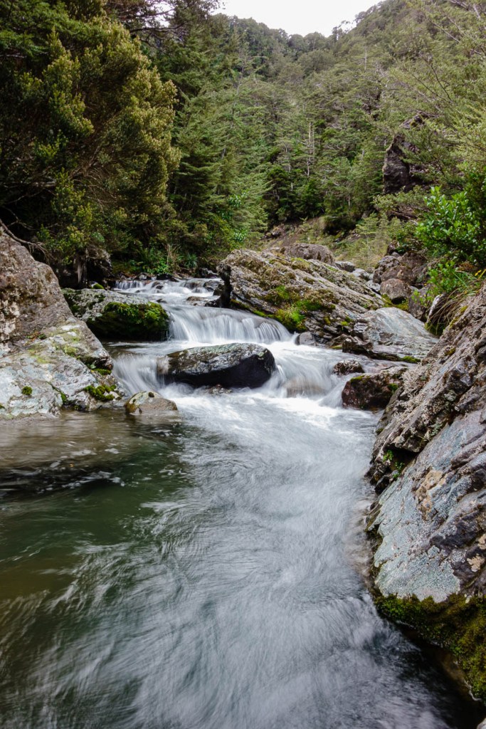
Past Waitonga Falls you have to cross unbridged water, and in spring or after heavy rain you’ll be faced with a fast-flowing stream and you will get soggy socks. Rocks that might otherwise provide a stepping-stone are submerged, haphazard in shape and size. No point trying to stand on one as the force of the water will simply push you off and, exposed or not, a rock isn’t guaranteed to stand firm – it will likely wobble or be as slippery as an egg. I don’t take my chances, plonking my foot into shallow water and wedging it behind a rock. And I’m not into hiking with wet feet so I only do it when the river is low.
Crossing the next stream isn’t the challenging part; getting out the other side is. It looks like a wall of steep bank and impenetrable bush, except one tree is a blue pole with an orange triangle at its top – a track marker. If your legs are twice as long as mine you’ll have no problems, otherwise you’ll do as I do and haul yourself up with the help of tree roots and branches and a prayer to the tramping gods that the crumbling soil will hold your weight for the few seconds it has to until you’re at the top of the bank.
Walk is a loose description of what your legs will do now. They’ll have to lift you up over broken steps and support you as you step down into ankle-deep mud. You’ll trip lightly along boardwalks for short distances, but you’re just as likely to trip over a tree root or slide down a bank. There’s no flat here, just up and down, into and out of small valleys gouged over millennia by multiple streams, some of which have swing bridges balanced precariously across them, most of which you’ll have to ford, the majority by getting your feet wet (in any season). Hiking in New Zealand is not for wimps.
The track climbs on a mix of eroded path, which can be a bit of a scramble, and boards built over the worst parts (yay for track maintenance!) In the forest and shaded by trees I’m still hot and breathing hard by the time we reach the junction, where I come millimetres away from braining myself on the low sign. We leave the circular trail and turn left, still going up, now on a ridge with the sound of a river below on our right. A grey warbler trills away somewhere, his song clear on a rare windless day. Depending on whether I’m paying attention, tree roots are either a foothold or a trip hazard, snagging toes and poles. Tiny leaves confetti the ground, a sign we are in beech forest, and the pale narrow trunks of silver beech rise beside us.
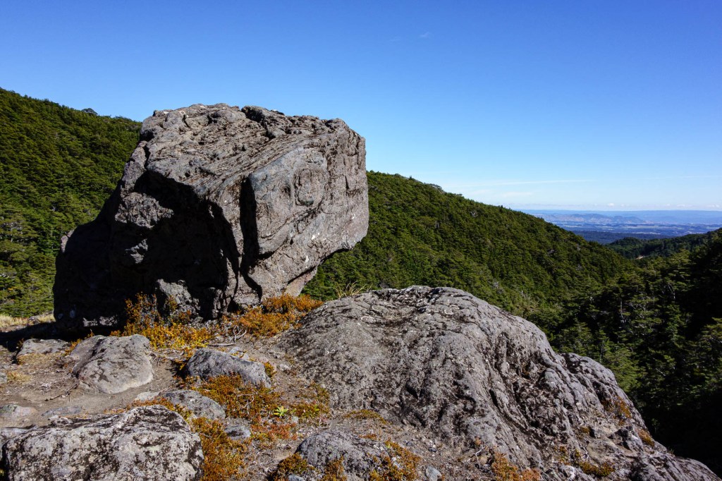
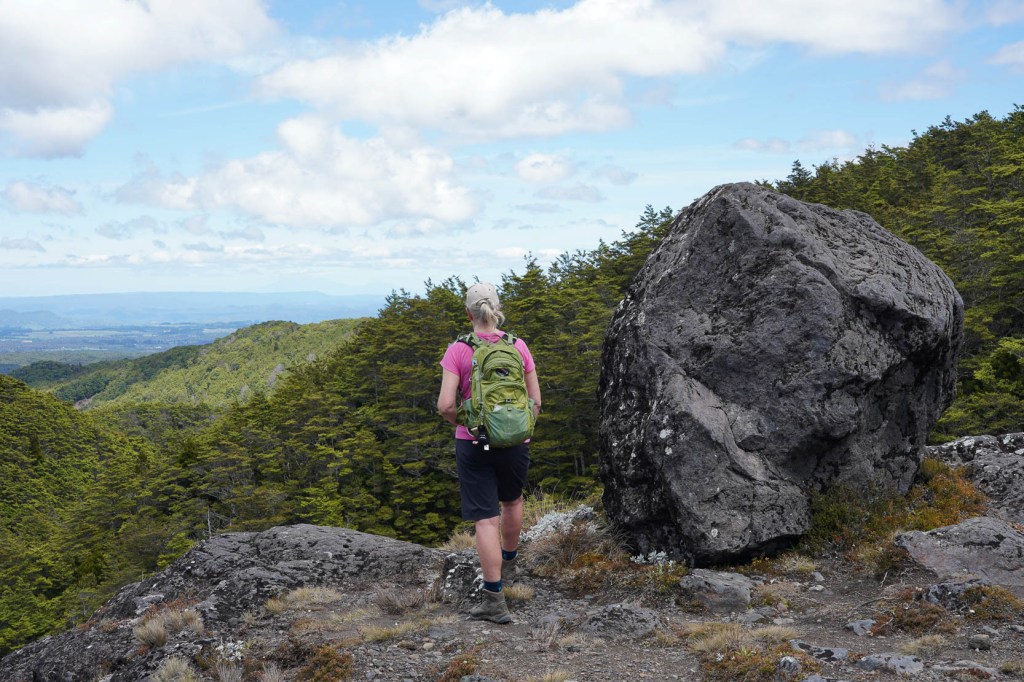
The path levels out at a small clearing. We paused here on our first visit, not realising that two minutes away the forest ends beside the river we’ve been hearing for a while. A huge boulder sits at the top of a steep drop, the view south stretching for miles behind it. The river here is one of the easiest on the mountain to cross with large rocks, untroubled by even high water, providing excellent footholds. I’m quite happy about this, especially as we cross it twice more.
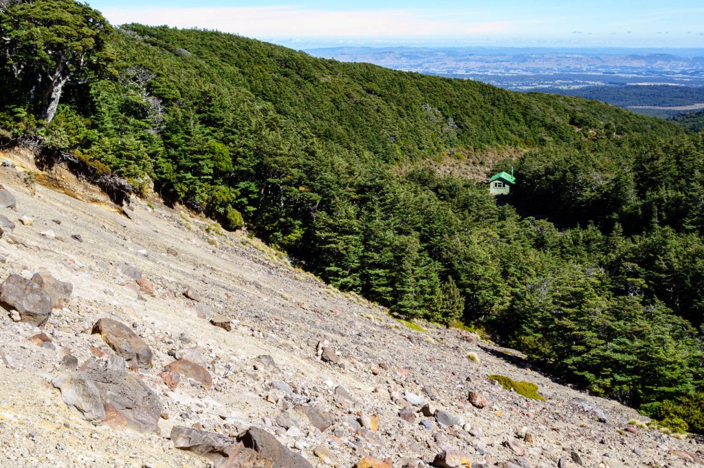
Just past Lupton Hut, a small green building nestled at the edge of low trees, we get a quick glimpse of the mountain above us before the contours of the land hide it. We zigzag up a scoria slope, loose stones underfoot ready to skittle the unwary, the heat of the summer sun bouncing off the ground onto us. Steep wooden steps take us back to tussock and low trees, then onto Blyth Hut. We walk on for a while, climbing behind the hut and above the treeline. Poles mark the way up the mountainside for a while before petering out, leaving you to make your own way across ridges until you reach the skifield base and the top of the mountain road. We’ve done this in the past, driving up and chaining our bikes to a fence before we walk so we can zip down the road to the car in minutes rather than slog it on foot for an hour.
Today we’re walking back the way we came and, the sun too hot to allow us to sit on the open mountainside, we return to the hut and seek shade on its wide deck to eat lunch. Below us to the south the buildings of Ohakune are tiny. To our left – east – steam rises from the distant pulp mill. Tall trees to our right, usually buffeted by the wind they offer shelter from, today stand still and silent. All we can hear is the crunch of radishes and the occasional chirrup from a bird. A huge dragonfly detours his flight to check us out before moving on. Not a bad picnic spot, Joe.
*It was only when I asked Neil for pictures to accompany this post that we realised we have no photo of Blyth Hut. It’s not really surprising – it’s a standard Kiwi backcountry hut, unprepossessing in itself, its attraction being the terrain in which it sits.

thanks for sharing
LikeLike
You’re welcome! Thanks for reading :o)
LikeLike