Omakau to Oturehua: 29km, plus 5km to Ophir.
Before we continue the trail we detour to Ophir, the area’s largest town until the rail line was built through Omakau instead (would love to have been in on that conversation – Wha-a-a-t?!) It holds the record for the greatest temperature range in New Zealand, something we’re beginning to appreciate, cold mornings turning into scorching days. This morning the sky is clear but the sun hasn’t yet found its warmth and we cycle away from the Postmaster’s House sporting warm layers.


Ophir reminds me of my own heritage, its solid buildings and wide stone-kerbed pavements creating a pang of nostalgia for similar villages across Britain. When European settlers arrived in Central Otago the tallest tree was a spindly bush near knee height, nothing that could be used for shelter, instead they built using the local rock. Structures like these are a rare sight in the rest of New Zealand, where plentiful forests were razed to provide building material, and walking around we can’t help but feel as though we are back in the northern hemisphere.
Testament to their building material, many of the original town buildings still stand, although most are now private residences. The Old Post Office is, remarkably, still serving as such and is the longest operating one in New Zealand, the building now in the care of the Historic Places Trust. Stuffed with artefacts going back to when it first opened – the original clock still hangs on the wall, alongside it the old telephone exchange – it’s a fascinating insight into the past. If the postmaster isn’t too busy hand-cancelling the day’s post they will give you a short tour, even allowing you to wield the stamp yourself if you buy a postcard there to send. Money well spent I say. A couple of doors along the street Pitches Store, once a grocery and butcher’s shop, has been carefully renovated and is now a restaurant with accommodation, handily open as a café during the day, serving delicious scones and good coffee.
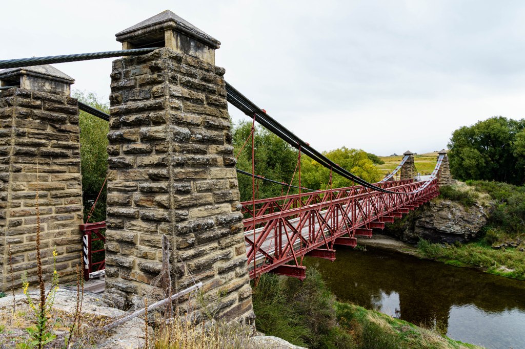
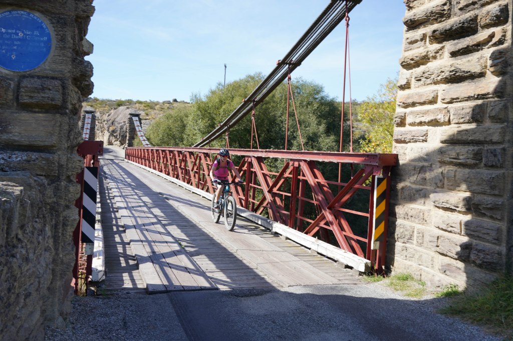
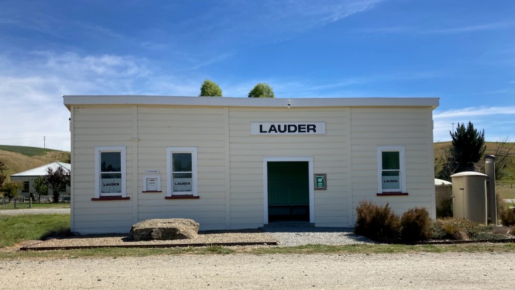
After a detour to the impressive Daniel O’Connell bridge, one of the last surviving suspension bridges in Central Otago, we head back to the trail, pedalling through open farmland towards Lauder. Named after the Scottish town, it has one of the cleanest pollution-free atmospheres in the world, but I’d guess there’s a lot of competition for that title around here. An overgrown platform marks the old station and the nearby Stationside café offers freshly made takeaway sandwiches. As they are prepared we chat with the owners who bought the business just before lockdown last year. It was a hard few months for them but thankfully trade has returned to normal since, even without overseas tourists.
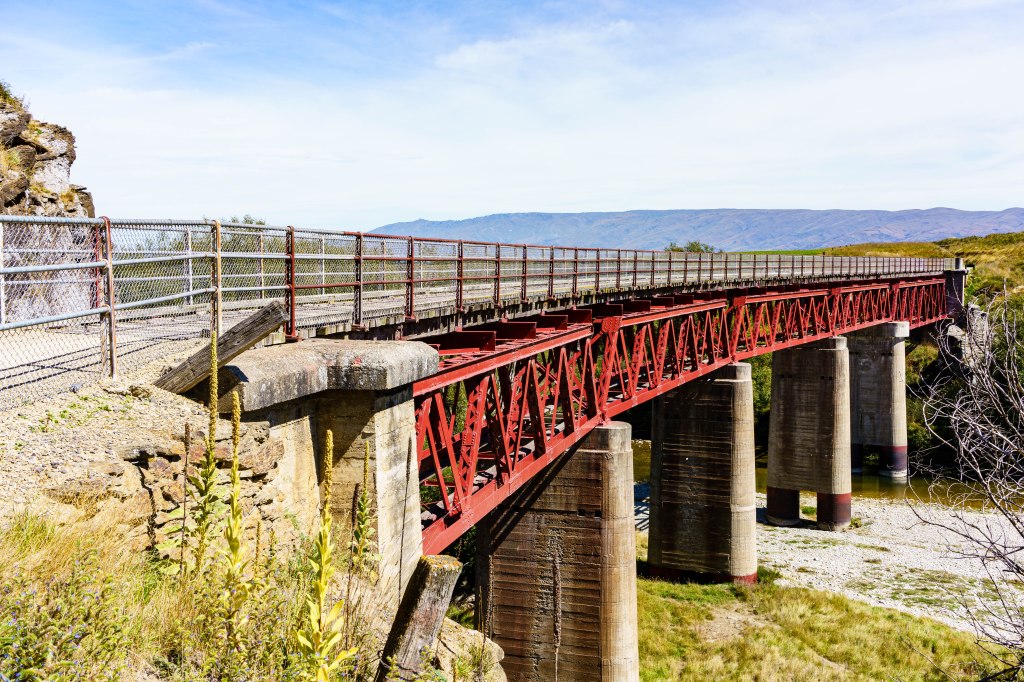

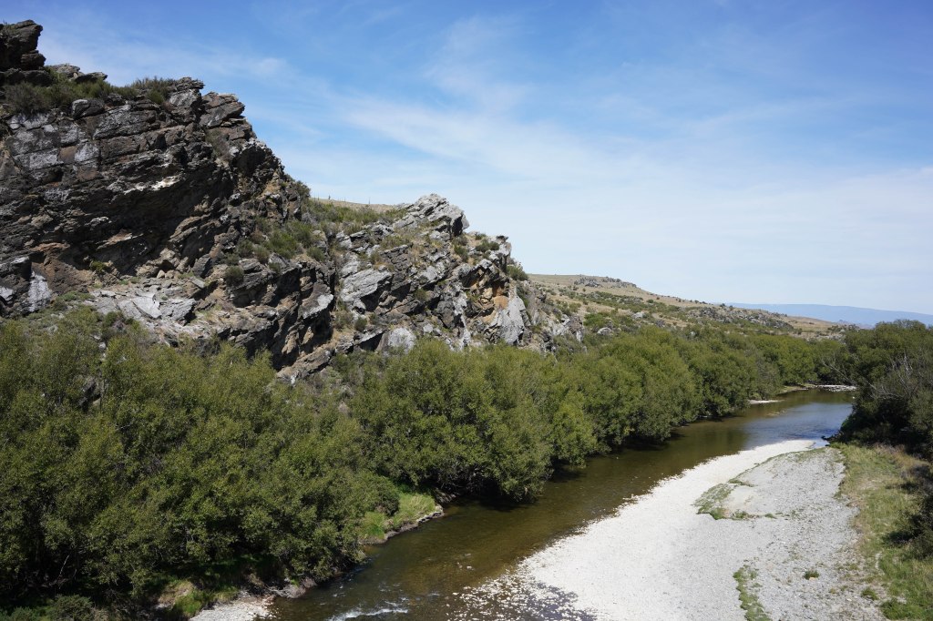
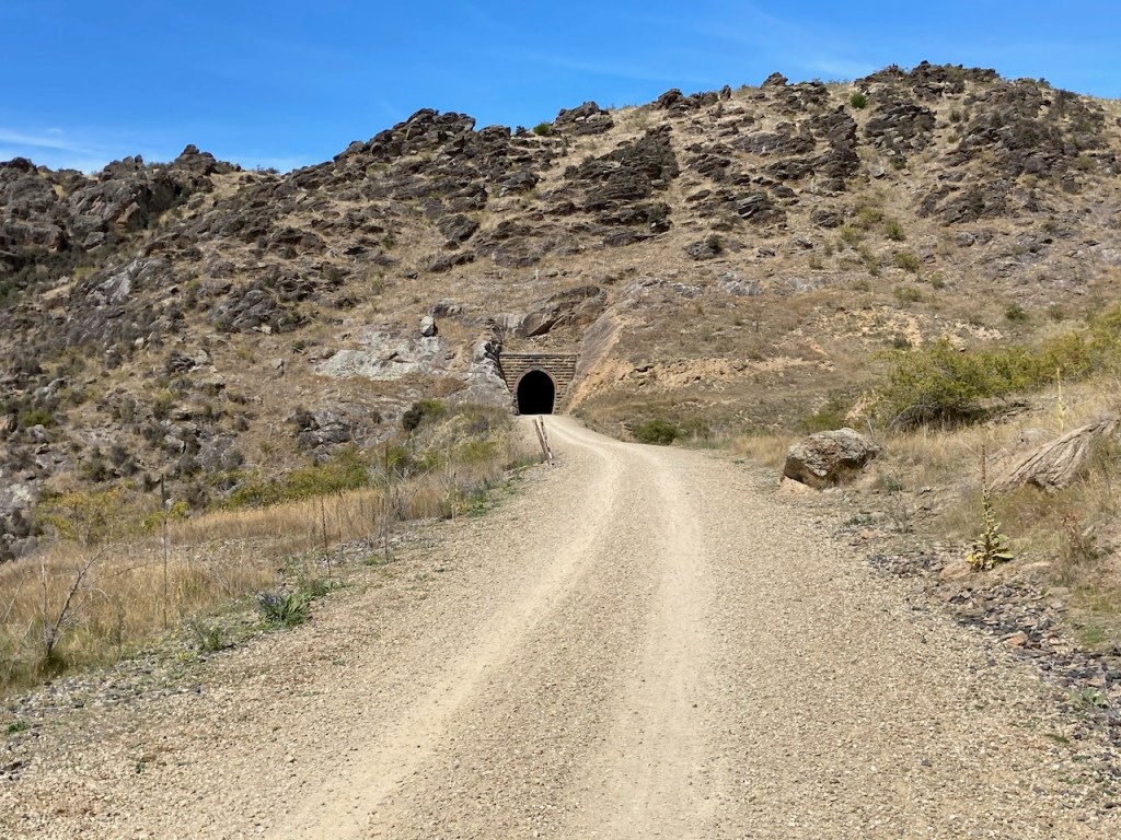
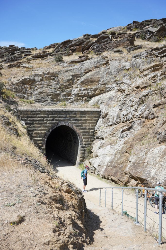
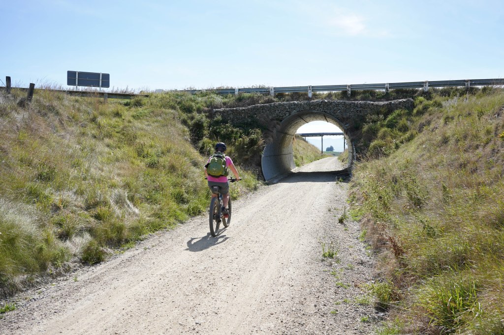
After Lauder the trail leaves the Manuherikia valley, crossing the unimaginatively named fourteen metre high Bridge No 1, and cuts through the Raggedy Range via the Poolburn Gorge. This rough and tumble countryside is described as the most dramatic section of the trail, and the building of the rail line through it is testament to the stamina and skill of early linesmen who did so with little more than physical labour. Steep schist cliffs tower over us, cuttings driven deep through them. Tunnels, their cool interiors a welcome break from the heat of the sun, punch through hills. At 229 metres the Poolburn Tunnel is the longest and comes with a bend in the middle that means a small section of total darkness. Pre-warned, we’re carrying torches and I follow the recommendation to dismount and walk. Even with bike light and torch, I know any attempt on my part to cycle in the dark will not end well, and walking allows an opportunity to admire the workmanship of those early toilers. The lower walls are rough, hewn from the hard rock, but the arched roof is perfect lines of neat bricks.
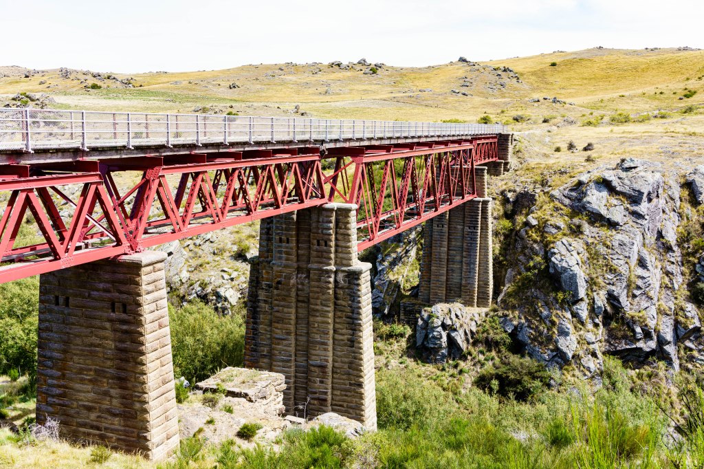
As it began with a high bridge, the gorge ends at the equally impressive Poolburn Viaduct, a feat of engineering even today, let alone when it was constructed early last century. There’s a picnic table at its end but no shade and the early afternoon sun is sizzling so we continue on, pausing further on at a bench in the shade of a tree for lunch. I’m sure it’s not just hunger and fresh air that make it one of the best sandwiches I’ve ever eaten and we toast the café at Lauder.
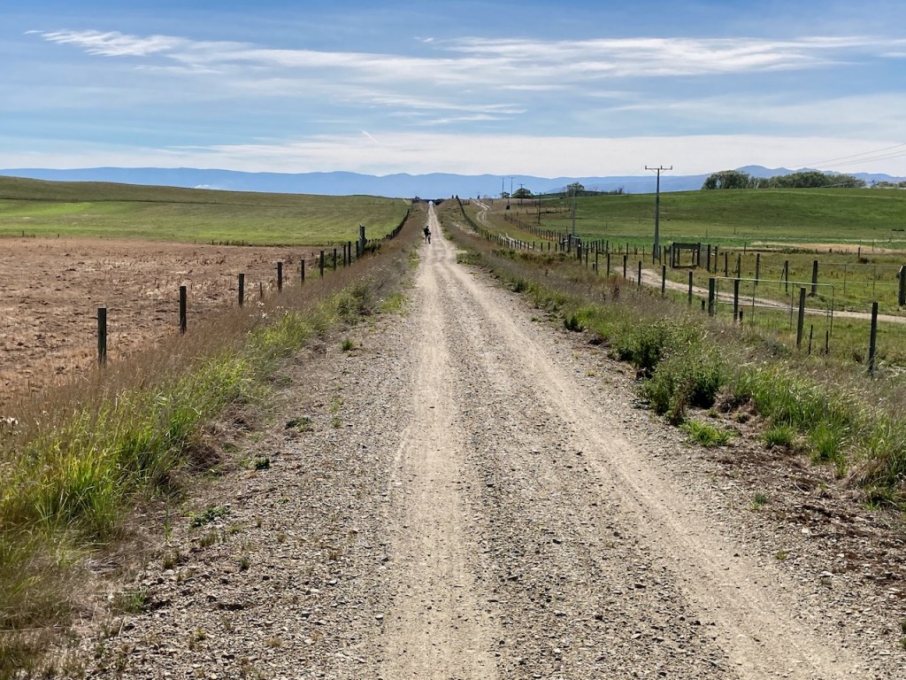
To our right the Ida Valley and a wide view across to Rough Ridge opens up. This countryside is huge, dwarfing the tiny humans that propel their way through it on puny machines. From here to Oturehua the track is mainly downhill through farmland, signs marking stations (the farming variety rather than rail). The tiny Idaburn Dam, scene of local curling competitions in the harsh winters this valley suffers, lies serene and blue, and Hayes Engineering, site of many important farming inventions (some still in use worldwide today) flashes by. We explored it a few days ago so cycle on.

High cloud has hidden the sun, making the heat less intense, but the last section as we near the town is inexplicably challenging for all of us. The track has become rough and stony, making forward momentum hard to maintain, and it feels slightly uphill. We’ve cycled ten km less than yesterday but my legs are heavy and I’m glad when we reach Inverlair Lodge and a warm welcome from Tony and Kathy. Other cyclists are already relaxing in the large lounge and a plate of shortbread sits by the kettle.
The tour company have booked a shuttle to the local pub for dinner but we choose to walk the km back along the track to the village, a nice stroll in the warm evening. Again, the quality of the food is excellent, Neil particularly impressed with the lamb rack. Locals line the bar. Some of the finest literary figures in New Zealand live in this area, including an ex-poet laureate, and I’d love to know who they all are, but even though I spot our hosts amongst them, I’m not brave enough to venture over to chat.
The sun has gone and the evening already cool as we walk back to the Lodge. I’m no meteorologist but I foresee another cold start tomorrow.
