Pou Herenga Tai, the Twin Coast Cycle Trail, runs from Opua (Or-poo-a) to Horeke (Hoar-ay-kay) in the far north of New Zealand. It’s 80-odd km of mostly flat cycling along old railway routes and paper roads, a not too strenuous two-day ride across the narrowest east-west part of this country. You can start at either end or, as we opt to do, stay in the middle (Kaikohe) and cycle to each end, using a local shuttle company to bring us back to our accommodation.
This is not an affluent area, with high unemployment and little capital, meaning Kaikohe (Kai-ko-hay) appears somewhat unprepossessing, a long line of shop fronts, many unoccupied, along the main street. But locals say its wealth is of the non-monetary sort, community and culture, and it’s a friendly little town. A highlight is the old bank building restored to a three-pronged hospitality venue: Left Bank is a boutique hotel, Mint an excellent café/restaurant, and Safe As a budget hostel. It’s a stunning building, beautiful inside, helping to support the local economy and employing local staff; a great base for the cycle trail, drawing visitors that would otherwise bypass the town.
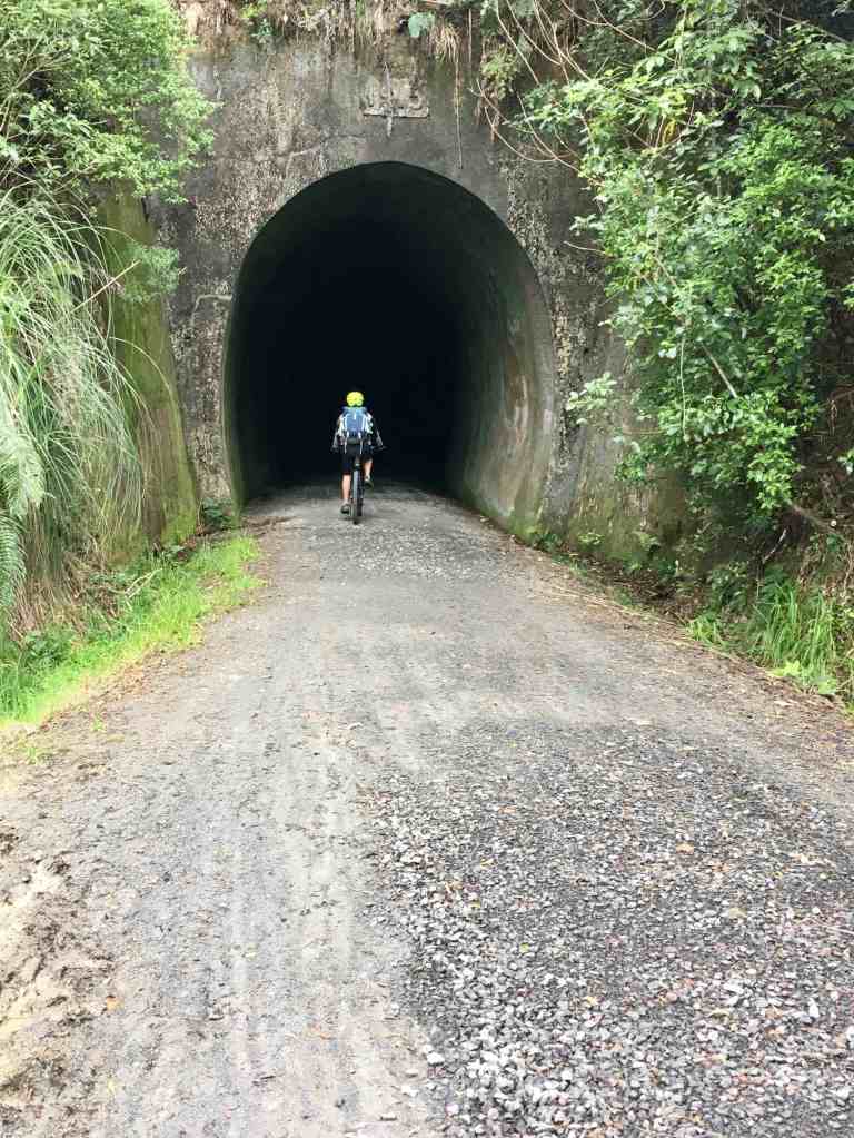
Day One. Riding ride west towards Horeke the first few km seems flat but my legs tell me otherwise; maybe it’s the effort they’ve recently put in on Waiheke Island but they refuse to work as well as they should. It’s an ill omen for the next 80km. The track rises imperceptibly through farmland and a long, curved tunnel (I walk) to Lake Omapere (Or-mah-pay-ray), the high point of the trail. A large shallow lake, barely a metre deep for the most part, it stretches away from us, shimmering silver under similar coloured clouds. A line of trees marches up the hill across it, soon obscured by rain that catches us as we ride past the lake with nowhere to shelter, a familiar situation this holiday.
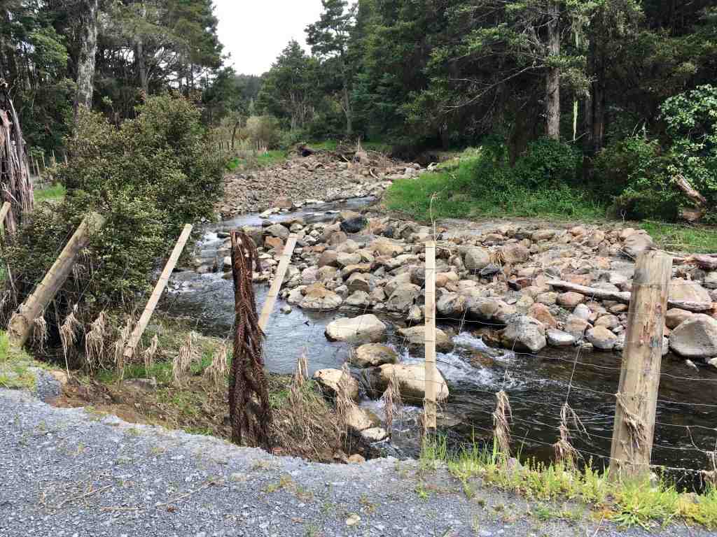
We’re damp as we ride into Okaihau (Oh-kai-hoe), characteristic small-town New Zealand, with a main road boasting a few shops and a garage. There’s also a small café, with surprisingly good coffee (amazing how easy it is to find bad coffee in NZ) and ‘the best chocolate cookie I’ve ever tasted’ declares Neil, buying a second one to take away. Re-fuelled we cycle out of town alongside the road and a couple of historic churches for a few km before swinging off to ride a gradual descent between fields, tall stands of bamboo shelter-belts marking boundaries. It’s a fun section, the track mainly smooth, but gutters and deep runnels across it evidence of the huge storms that swept through this region recently. We drop steeply down a hillside to a wide valley. As I swing around a curve I pull over in amazement where the fence hangs in mid-air over the torn banks of the river. The side is washed completely away, twigs and grasses trapped on the lower wires of the fence showing how high the water reached, large trees abandoned metres above today’s waterline.
We follow the Utukura (U-too-koo-rah) river through a beautiful green-sided valley, reminiscent of Derbyshire, the water gurgling beside grassy areas perfect for a picnic – if it hadn’t started raining again… At the end of the valley we ride alongside metalled farm roads for a few km, the advertised flat in reality rolling up and down. Some of the uphill sections, albeit short, are quite steep and challenging for my tired legs. I make a mental note to contact the trail’s marketing department.
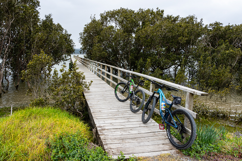
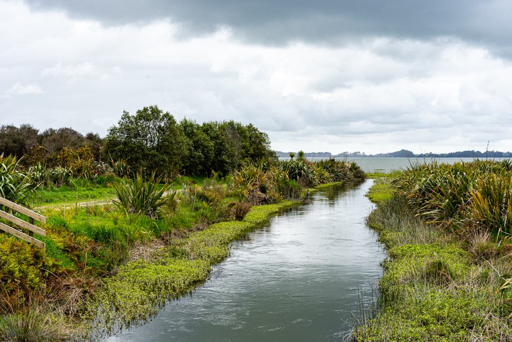
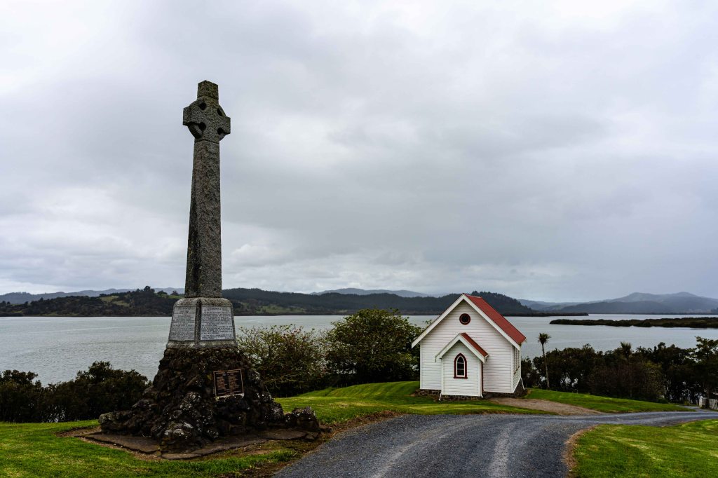
At the tiny settlement of Horeke a boardwalk runs over the mudflats towards the Hokianga (Hoe-kee-an-gah) Harbour, ethereal in the misty rain that hovers over it. We cycle to the end of the trail at Mangunga (mah-noon-ah), where a long pier stretches out into the milky-tea water, eddies whirling under it as the tide recedes. The air is still and, apart from us, it’s absolutely deserted. The Wesleyan Mission House sits on a rise alongside a small chapel. One of Northland’s oldest buildings, it’s the place where Te Tiriti o Waitangi (the Treaty of Waitangi) was signed by the largest number of Maori leaders.
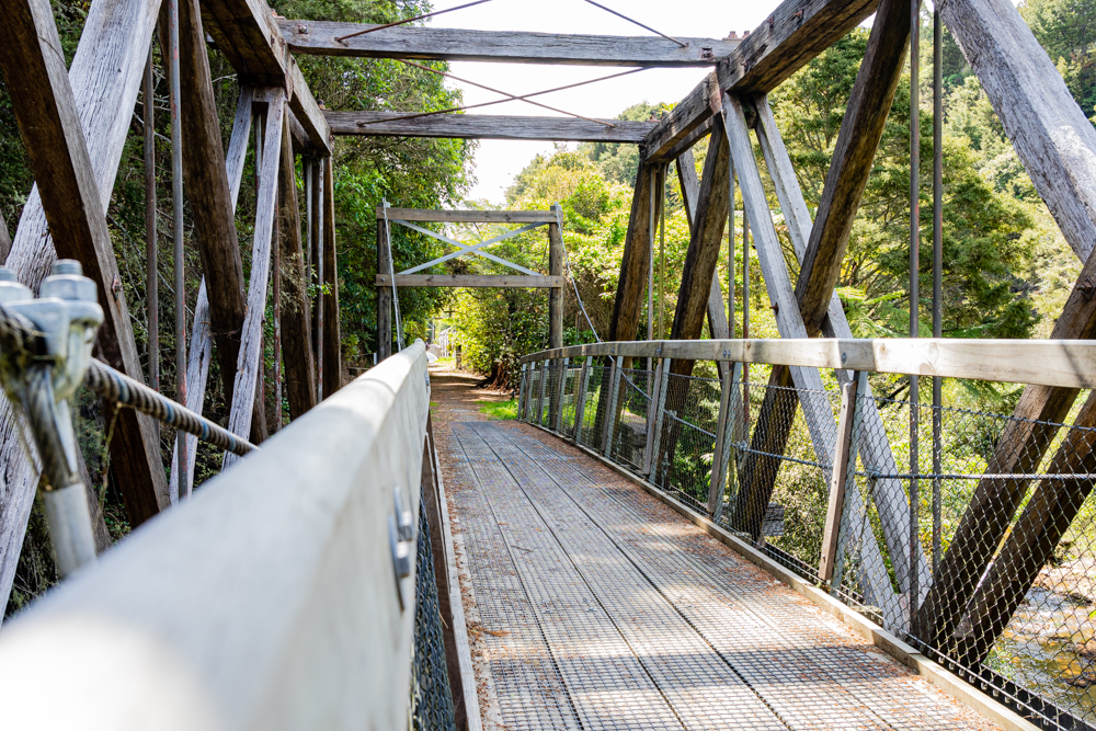
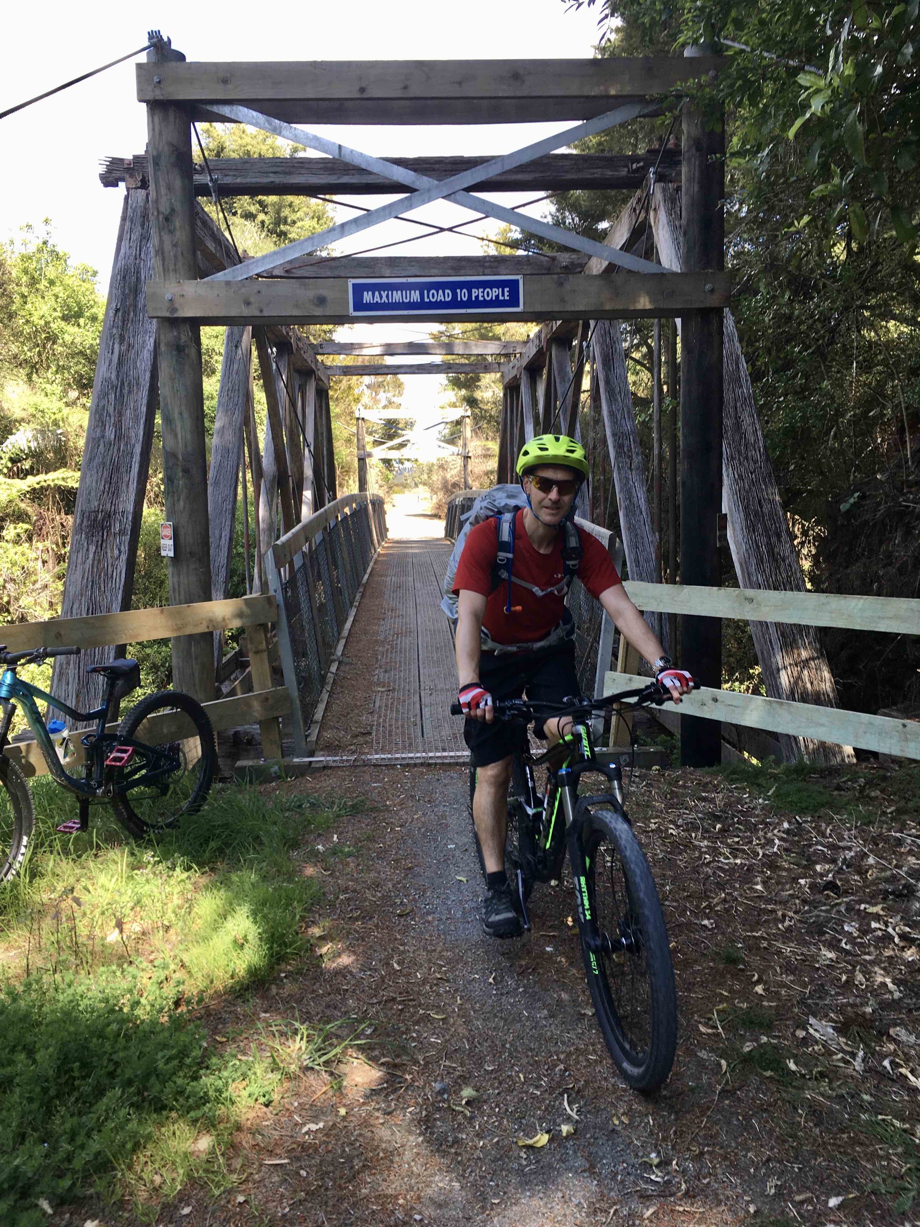
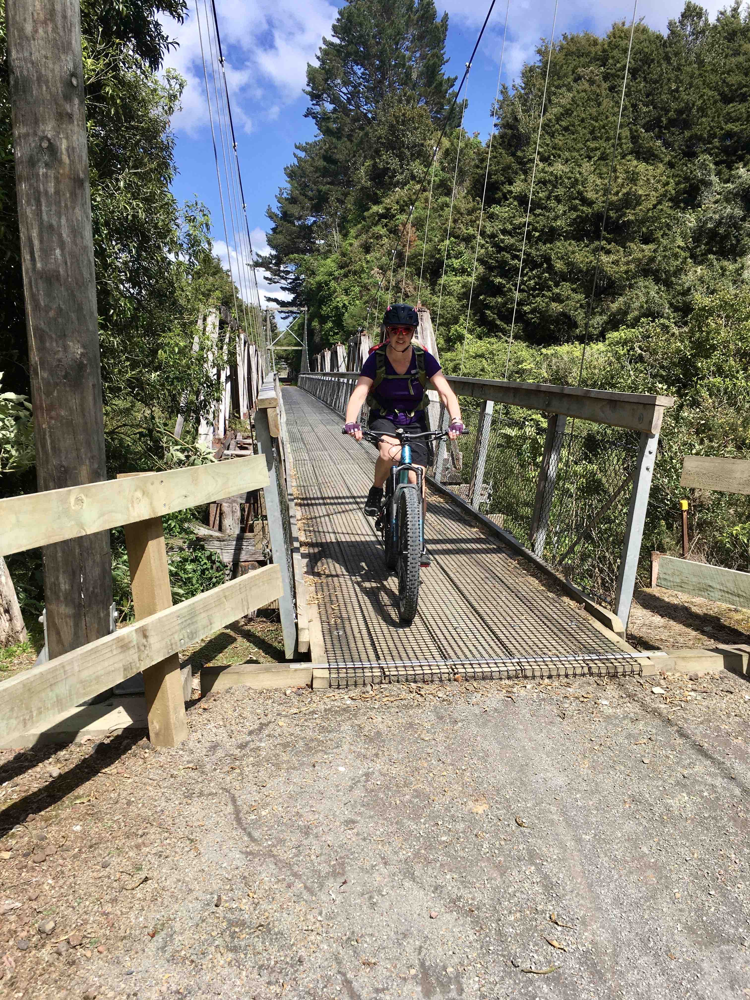
Day Two. The first half runs through farmland behind small towns, an easy and pleasant ride with the sun warm upon us, then through a series of cuttings to cross a couple of impressive suspension bridges over the Orauta (Oh-roe-tah) Stream. On a raised section huge chunks of the track have fallen away to the lower marshy land alongside, eaten away by the storms that flooded the area. We manoeuvre around a friendly team and their vehicles as they work to repair it. I wonder if the water that trickles across the flat land a couple of metres below us is normal, or if we should be looking at fields of crops and grazing animals.
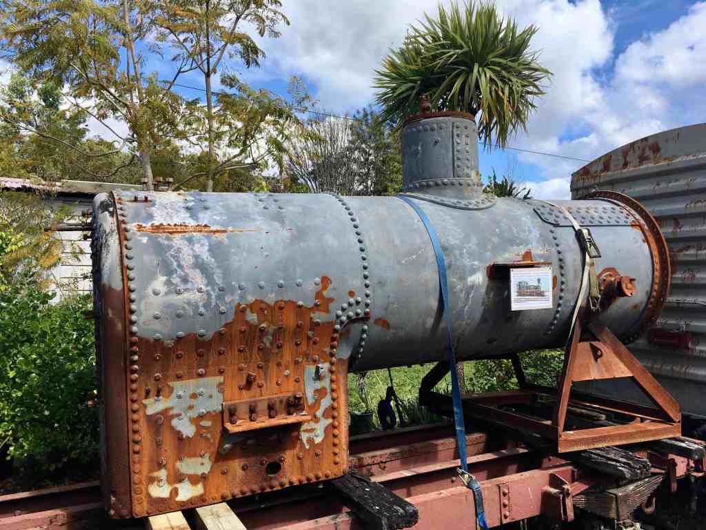
Kawakawa has an unusual claim to fame – its main attraction is a public toilet, which sounds weird, but they were designed by Friedrich Hundertwasser. The Austrian artist lived near here for the last years of his life and this was the last project completed during his lifetime. Sadly they are closed and fenced off for renovation. Thankfully the café at the station isn’t and, as we re-fuel, we discover that a vintage train runs from here to the coast on weekends and holidays. A notice announces that the train is currently pulled by a diesel engine as Gabriel the Big Engine’s boiler has blown and it will cost $350k to replace it. The buggered one sits in a siding by the café, a huge thing almost the size of the engine itself, something I’ve never really thought about before.
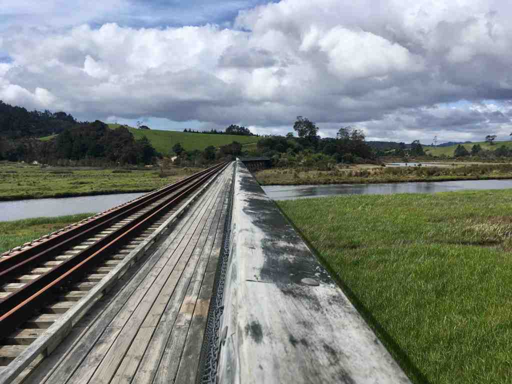
We cycle out of town beside the rail line through more farmland, attracting the attention of a magpie, a cyclist’s hazard in spring. I’m on a flat track with no obstacles, or the thump on my helmet (which feels like someone has thrown something at me) might end differently – me in an untidy heap on the ground with, given my track record, an injury of some sort. I throw a few swear words after it. At Taumarere (Toe-ma-rare-ay) the train line ends at a spectacular curved viaduct that crosses rivers of bright blue water meandering through wetlands, grey-green grasses and reeds waving in a fairly stiff breeze. I watch a pukeko (poo-kay-ko) pluck a small eel from the water, which puts up a brief fight then hangs limp as the bird disappears into the long grass.
The tunnel on this section is marked as dangerous and closed for repair. We can see no gate barring access but, being anal rule-followers, we take the marked detour. It’s almost vertical and I immediately climb off and push; Neil tries manfully to cycle it. But this is challenging merely to walk up, the surface rough and slippery, so even he has to accept defeat. It’s a cruel test after nearly 80km, and our driver later tells us we could have cycled through the tunnel as it’s only as dangerous as any 100-year-old tunnel would be. Wish I’d known that!
The final stretch is along a high bank between mangrove swamps along the Opua estuary, glimpses of rail line telling of its original purpose. Funding has just been granted to allow for full restoration back to train use and optimism is high that there will be enough money for a new cycle track alongside or the trail will end at Taumarere. Our weather luck finally runs out – a few km from Opua the sky darkens and, once again, we pause to pull out waterproof jackets.

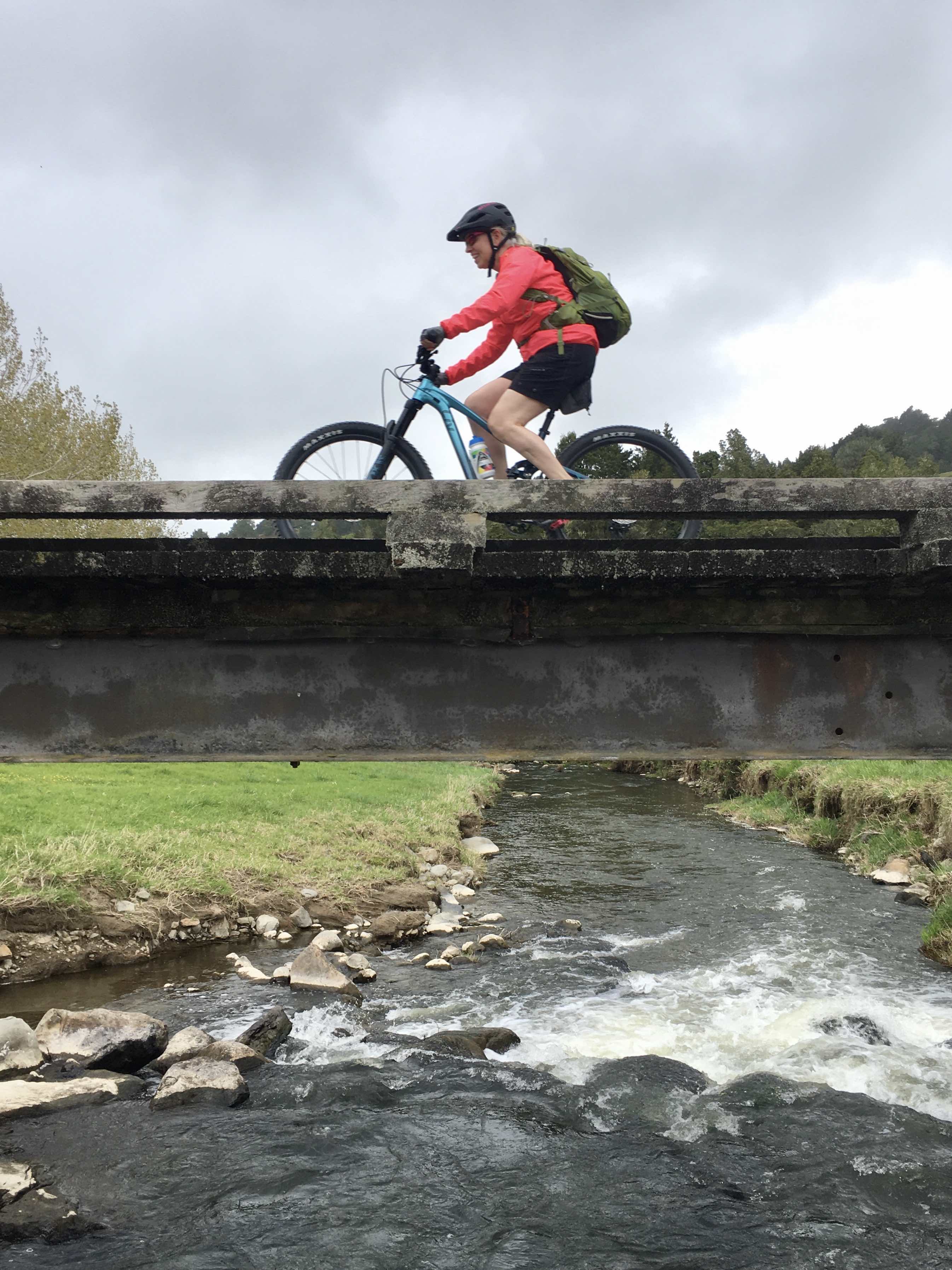
Notwithstanding my legs copping a strop it’s been a relatively easy couple of days. The entire track is wide and well-formed with no sudden hazards to manoeuvre around (unless you count magpies). There are a few well-signed road crossings and a short detour onto a quiet road, but otherwise it’s a great ride for families, historically fascinating. I’d advise taking a raincoat though.
Note: some of these places names should have a macron (remember the macron from my last post?) or two but, despite following instructions from every website I could find that referred to them, I can’t get my keyboard to comply. So they remain macron-less and I remain frustrated by technology.
